Michigan’s tallest waterfall is not Tahquamenon. It is not in a state park you have heard of, and for most of the last two decades you were not supposed to be standing anywhere near it.
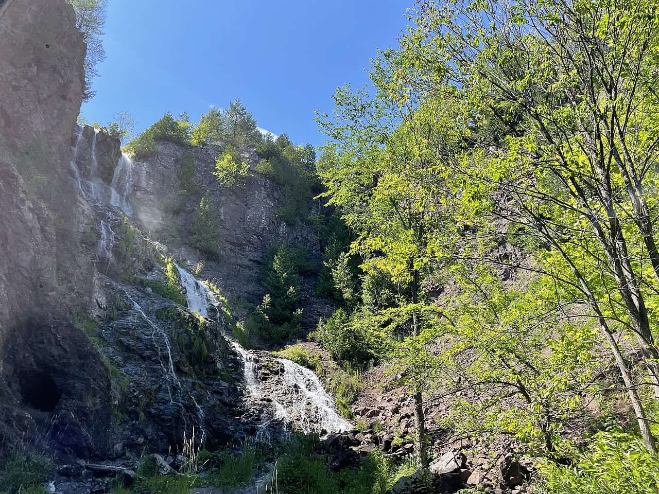
Houghton-Douglass Falls drops about 110 feet in one plunge, down a sheer wall of ancient volcanic rock into a narrow gorge cut by Hammell Creek. It is in Houghton County, roughly a mile and a half north of Lake Linden. Nothing else in the state falls that far in a single go.

Two cousins and a surveying party
The name honors Douglass Houghton, Michigan’s first state geologist, whose survey work set off the Copper Country rush, and his cousin Columbus C. Douglass. The two worked together on the geologic surveys of copper and iron in the Upper Peninsula. After Houghton drowned in Lake Superior in 1845, Douglass stayed on and became a figure in the region in his own right, helping drive the development of the Copper Country and serving in the Michigan Legislature.
You will see the falls written several ways — Douglass Houghton Falls, Douglass Falls, plain Houghton Falls. The official name is Houghton-Douglass Falls.
Why it got closed
For a long time this was simply where people went. Locals and Michigan Tech students hiked in, scrambled down, and swam in the plunge pool.
The problem is the gorge itself. The walls are steep, and the rock crumbles. There were accidents, a number of them fatal. The private landowner who had tolerated visitors eventually cut off access entirely, and the falls spent years posted against trespassing while photographs of them kept circulating on every Upper Peninsula Facebook group and tourism site in the state.
That produced the worst possible arrangement: a landmark everybody could see online, that nobody could legally reach, guarded by cliffs that had already killed people.

What the state has actually built
In 2018 the Michigan Department of Natural Resources bought the roughly 70 acres around the falls, with the intention of making it a scenic site and a veterans memorial. It is now designated the Houghton-Douglass Falls and Veterans Memorial Scenic Site.
Phase 1 finished in 2025. That work brought in an access road, a paved parking area, a vault toilet, an accessible trail, and a pedestrian bridge over Hammell Creek. The trailhead parking lot is labeled correctly on Google Maps, which was not true for most of this site’s history.
The part you need to know before you drive up
Here is the honest catch, and it is the reason to read this before packing the car rather than after.
You cannot see the main cascade from the new bridge. The bridge is a pleasant forest walk with a view of Hammell Creek, and the accessible trail is a real improvement over bushwhacking, but Phase 1 did not deliver a viewing platform over the falls themselves. Getting down to the base still means the same steep, loose gorge that caused the closures in the first place.
So go, but go with the right expectation. Treat the developed trail as the thing you came for. The gorge descent is not a hike; it is a scramble on crumbling rock, and the reason there is a parking lot at all is that people kept getting hurt doing it.
Before you drive up
The site sits in Calumet Township, a few minutes east of where US-41 meets M-26, about a mile and a half north of Lake Linden. Cell service in that stretch is unreliable, so pull up directions before you lose signal.
Construction is ongoing in later phases, so conditions change. If you want more falls in the same trip, the Keweenaw has plenty within an easy drive — we rounded up the best waterfalls in the U.P. — and you are ten minutes from the Calumet and Hecla country that made this whole corner of the state rich.
More worth reading


Yooper Hub community
The conversation
Know something this story missed? Corrections and additions get read by an editor and folded into the article, with credit.
Real neighbors, real names. A Yooper Hub editor reads your first comment before it appears; after that you’re a known neighbor and your comments post right away. No account required. Community guidelines
Nothing here yet. A sentence is plenty: a correction, a name, or what you remember about this place.
Sources, credits, and reporting details
Sources & accountability
How this story was reported
Editorial methodAggregation
Last verifiedAug. 15, 2026
Corrections statusNo material correction note is recorded on this article.
AI assistanceResearched and drafted with AI tools. Reviewed and approved by editor Keegan O’Brien. Tool: Claude Opus 5.
Verification note: Ledger reconstructed 2026-08-15 from the DNR's site page and 2025-2026 local coverage. Site status changes: Phase 1 (road, parking, toilet, accessible trail, bridge) finished 2025; Phase 2 with the falls overlooks is slated for 2027; the DNR temporarily closed and reopened the site in 2026. Recheck the DNR page before promoting this piece.
Primary sources
-
Houghton-Douglass Falls and Veterans Memorial Scenic Site — Michigan Department of Natural Resources
Accessed Aug. 15, 2026.
-
Houghton County park gets $1 million to complete upgrades — WNMU-FM
Published Dec. 12, 2025. Accessed Aug. 15, 2026.
Supports: Funding for the remaining phases and the state of the site after Phase 1.
Additional reporting
-
Now open — The Daily Mining Gazette
Published May. 1, 2026. Accessed Aug. 15, 2026.
Supports: The site's 2026 reopening after a temporary closure.
-
Houghton-Douglass Falls — Wikipedia contributors
Accessed Aug. 15, 2026.
Pointer.
Photo and media credits
-
Houghton-Douglass Falls (featured image) — Phoenix-Five, via Wikimedia Commons
Featured image record. Accessed Aug. 3, 2026. CC BY-SA 4.0.
Creator and license from the attachment caption. Attachment 2045, 1280×960.