Agate Falls is a broad band of cascades nearly 40 feet high on the Middle Branch of the Ontonagon River, and the half-mile walk to it starts at a roadside park on M-28 and goes through a tunnel under the highway. Overhead is a steel railroad trestle from 1900. This year you can look at that trestle but not cross it.
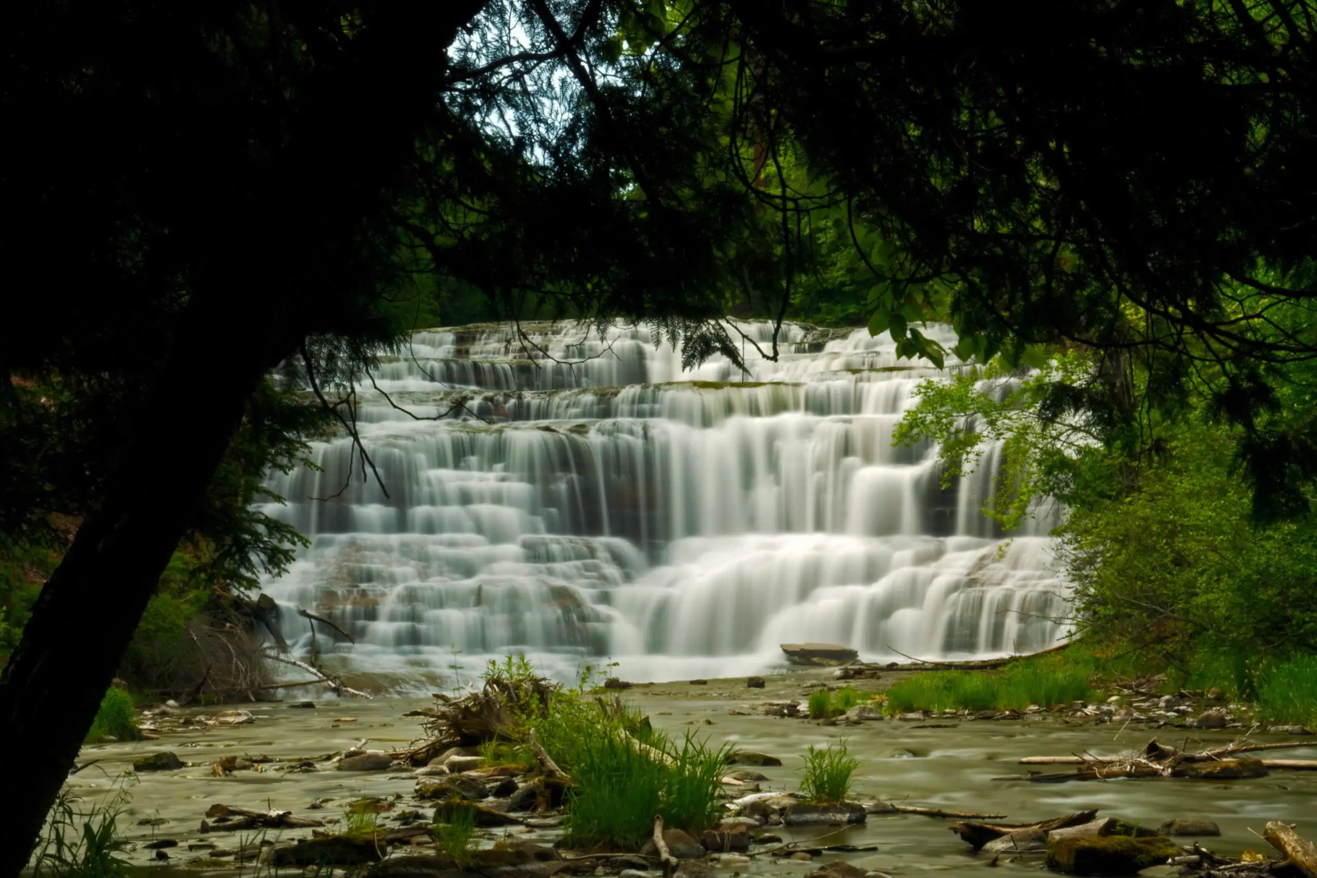
One long-running guide doubles the height. Michigan Interactive’s fishweb.com page says the river “cascades 80 feet over a series of shelves.” The Michigan DNR, which runs the scenic site, describes “interlacing cascades and small falls nearly 40 feet high,” made as the river works over “an extended shelf of terraced sandstone.”

A trestle with a second life
The DNR says the trestle “was originally built in 1900 before being given a second life as a trail bridge for ORV and snowmobile riders.” It carried the Duluth, South Shore and Atlantic Railway. Michiganrailroads.com, a rail history site, says it is 420 feet long and 20 to 110 feet high, built by the Lassig Branch of the American Bridge Company, and that it replaced a wooden structure.
The same site passes on a story with its own hedge on it: “It is said that South Shore trains would stop on the bridge to view Agate Falls.” We could not find anyone who rode one, so it stays a story. Today it carries the DNR’s ORV SB Route and a snowmobile trail over the river.
What changed this year
The DNR closed the site on April 17 for repairs to the trestle, funded by a $1.6 million Federal Highway Administration Recreational Trails Program grant. On Aug. 21 it announced the site would reopen to visitors Sept. 4, with one catch: “The trestle bridge will remain closed to pedestrian and ORV access in the meantime.”

ORV riders are on an 18.6-mile detour that starts at Mile W and follows Calderwood Road and Bond Falls Road back to the trail at LL. The detour replaces a 4.6-mile section of the route. The DNR says it will announce a new reopening date for the ORV trail and will share a snowmobile reroute when one is ready.
Getting there this month
Park at the Joseph F. Oravec Roadside Park on M-28, about 7 miles east of Bruce Crossing and 4 miles west of Trout Creek. The DNR’s trail is accessible and ends at an observation platform with a view of the top of the falls.
The roadside park has parking, vault toilets, a picnic area and a paved trail. The agency calls Agate Falls “one of Michigan’s most picturesque waterfalls,” and lists fishing and hiking among what people come for. The Ottawa National Forest’s page for the falls says the parking area and trail are maintained by the Michigan Department of Transportation, and calls the trail “not long but is moderately difficult in grade.”
Timing matters this week. The DNR says the site is “typically open for vehicle access mid-May through mid-October,” while the trail stays open year-round without snow or ice grooming. The roadside park is generally open early May through late October.
Go See It
Agate Falls Scenic Site, Trout Creek
- Hours
- No posted daily hours. The trail is open year-round; trails and boardwalks are not maintained for snow and ice.
- Cost
- Parking is at an MDOT roadside park. The DNR page carries only its general Recreation Passport line for state campgrounds; no site fee is listed.
- Season
- Vehicle access typically mid-May through mid-October (DNR). Roadside park generally early May through late October. Trestle closed to walkers and ORVs during repairs (DNR, Aug. 21, 2026).
- Drive
- From Marquette: 1 hr 37 min (86.2 mi) via US-41 N and M-28 W
From the Bridge: 4 hr 11 min (249 mi) via US-2 W and M-28 W
More worth reading


Yooper Hub community
The conversation
Know something this story missed? Corrections and additions get read by an editor and folded into the article, with credit.
Real neighbors, real names. A Yooper Hub editor reads your first comment before it appears; after that you’re a known neighbor and your comments post right away. No account required. Community guidelines
Nothing here yet. A sentence is plenty: a correction, a name, or what you remember about this place.
Sources, credits, and reporting details
Sources & accountability
How this story was reported
Editorial methodAggregation
Last verifiedOct. 5, 2026
Corrections statusNo material correction note is recorded on this article.
AI assistanceResearched and drafted with AI tools. Reviewed and approved by editor Keegan O’Brien.
Verification note: Sources read and checked Oct. 5, 2026.
Primary sources
-
Agate Falls Scenic Site — Michigan DNR
Accessed Oct. 5, 2026.
Supports: Nearly 40 feet; terraced sandstone; Middle Branch of the Ontonagon
[Chrome] "The falls are created as the river finds its way over an extended shelf of terraced sandstone. The resulting waterfall is a broad band of interlacing cascades and small falls nearly 40 feet high." / "located along the middle branch of the Ontonagon River"
-
Agate Falls Scenic Site — Michigan DNR
Accessed Oct. 5, 2026.
Supports: Half-mile trail to platform at top of falls; tunnel under M-28; overhead trestles
[Chrome] "A half-mile trail provides access to an observation platform with views of the top of the falls. The trail passes through a tunnel under M-28 and you can also view overhead railroad trestles."
-
Agate Falls Scenic Site — Michigan DNR
Accessed Oct. 5, 2026.
Supports: Roadside park amenities and season; accessible trail
[Chrome] "Parking, vault toilets, an adjacent paved trail and a picnic area are available at the adjacent MDOT roadside park (generally open early May through late October)." / "Visitors can access the observation platform via an accessible foot trail."
-
Agate Falls Scenic Site — Michigan DNR
Accessed Oct. 5, 2026.
Supports: Vehicle access mid-May to mid-October; trail year-round, not groomed
[Chrome] "Depending on weather conditions, the site is typically open for vehicle access mid-May through mid-October. Trail access is open year-round; however, trails and boardwalks are not monitored or groomed for snow and ice."
-
Agate Falls Scenic Site — Michigan DNR
Accessed Oct. 5, 2026.
Supports: Superlative attributed to DNR; phone; ORV SB Route; 4.6-mile section rerouted
[Chrome] "Considered one of Michigan's most picturesque waterfalls" / "Phone: 906-353-6558" / "the DNR has rerouted a 4.6-mile section of ORV SB Route on a detour totaling 18.6 miles"
-
Agate Falls Scenic Site opens Sept. 4 to visitors; ORV trail remains closed — Michigan DNR
Published Aug. 21, 2026. Accessed Oct. 5, 2026.
[Chrome] "will be reopened to visitors Sept. 4" / "The site's railroad trestle was originally built in 1900 before being given a second life as a trail bridge for ORV and snowmobile riders." / "$1.6 million Federal Highway Administration Recreational Trails Program grant" / "The trestle bridge will remain closed to pedestrian and ORV access in the meantime."
-
Agate Falls Scenic Site opens Sept. 4 to visitors; ORV trail remains closed — Michigan DNR
Published Aug. 21, 2026. Accessed Oct. 5, 2026.
[Chrome] "follow the designated 18.6-mile reroute, which begins at Mile W and continues to Calderwood Road. Calderwood becomes Bond Falls Road before reaching 'LL' on the trail." / "An updated reopening date for the ORV trail will be announced soon." / "The DNR will provide information about a potential snowmobile reroute when it becomes available." / "including fishing, hiking and ORV riding"
-
Agate Falls Scenic Site in western UP closed through fall — Michigan DNR
Published Apr. 17, 2026. Accessed Oct. 5, 2026.
Supports: Closed April 17 for trestle repairs
[reader] "temporarily closed through late fall for essential repairs and improvements to the site's trestle bridge."
-
Agate Falls Scenic Site Area Map — Michigan DNR
Accessed Oct. 5, 2026.
Supports: Bruce Crossing 7 miles; Trout Creek 4 miles
[reader] "Bruce Crossing 7 miles" / "Trout Creek 4 miles"
-
Google Maps place, Agate Falls Scenic Site — Google Maps
Accessed Oct. 5, 2026.
Supports: GPS of the scenic site
Read Oct 5, 2026: 46.4781754, -89.0898346.
-
Google Maps directions, Marquette to Agate Falls Scenic Site — Google Maps
Accessed Oct. 5, 2026.
Supports: Drive time from Marquette
Fastest route read live Oct 5, 2026: 1 hr 37 min (86.2 mi) via US-41 N and M-28 W.
-
Google Maps directions, Mackinac Bridge to Agate Falls Scenic Site — Google Maps
Accessed Oct. 5, 2026.
Supports: Drive time from Mackinac Bridge
Fastest route read live Oct 5, 2026: 4 hr 11 min (249 mi) via US-2 W and M-28 W.
Additional reporting
-
Agate Waterfall Ontonagon County — Michigan Interactive (fishweb.com)
Accessed Oct. 5, 2026.
[Chrome] "Right on M-28, at Joseph. F. Oravec Roadside Park four miles west of Trout Creek." / "The river is about 80 feet wide as it cascades 80 feet over a series of shelves." DNR gives nearly 40 feet.
-
Ontonagon River (DSSA) Bridge, Trout Creek (Agate Falls) — michiganrailroads.com
Accessed Oct. 5, 2026.
[Chrome] "The DSS&A built this trestle over the Middle Branch of the Ontonagon River, next to Agate Falls in 1900. The trestle was constructed by the Lassig Branch of the American Bridge Company. It is 8' wide and 420' long … It is 20' to 110' high." / "It is said that South Shore trains would stop on the bridge to view Agate Falls. This bridge replaced a wooden structure."
-
Agate Falls (Ottawa National Forest) — USDA Forest Service, Ottawa National Forest
Accessed Oct. 5, 2026.
Supports: Parking and trail maintained by MDOT; trail moderately difficult (conflicts with DNR 'accessible')
[Chrome] "The trail to the falls is not long but is moderately difficult in grade. The parking area and hiking trail are maintained by Michigan Department of Transportation."
Photo and media credits
-
Agate Falls in Michigan's UP (17522565272).jpg (media 4120) — Wikimedia Commons / Bobbie Halchishak, U.S. Fish and Wildlife Service
Featured image record. Accessed Oct. 5, 2026. Public domain.
Supports: Image credit and licence.
Commons file page metadata read Oct 5, 2026: licence Public domain, author Bobbie Halchishak, U.S. Fish and Wildlife Service. Original 3456×2304; uploaded 2560×1707 (not cropped; downscaled only if wider than 2560). Viewed before alt text was written.
-
Agate Falls (265409244).jpg (media 4118) — Wikimedia Commons / James Phelps
Accessed Oct. 5, 2026. CC BY 2.0.
Supports: Image credit and licence.
Commons file page metadata read Oct 5, 2026: licence CC BY 2.0, author James Phelps. Original 1200×800; uploaded 1200×800 (not cropped; downscaled only if wider than 2560). Viewed before alt text was written.
-
Agate Falls.jpg (media 4119) — Wikimedia Commons / Joe Passe
Accessed Oct. 5, 2026. CC BY-SA 2.0.
Supports: Image credit and licence.
Commons file page metadata read Oct 5, 2026: licence CC BY-SA 2.0, author Joe Passe. Original 1800×1215; uploaded 1800×1215 (not cropped; downscaled only if wider than 2560). Viewed before alt text was written.
.jpg)
.jpg)
