The danger at Au Sable Point is that you cannot see it. A ridge of sandstone runs off the point and continues nearly a mile out into Lake Superior, and in places it sits just six feet below the surface. Six feet is nothing. A loaded ship draws more than that, and through the middle of the 1800s the reef collected vessels the way a nail collects a tire. Sailors called this stretch between Grand Marais and Munising the shipwreck coast, and they were not being dramatic. The passenger steamer Lady Elgin ran onto the reef and stuck there in 1859, a year before she went down on Lake Michigan in one of the worst disasters in Great Lakes history.
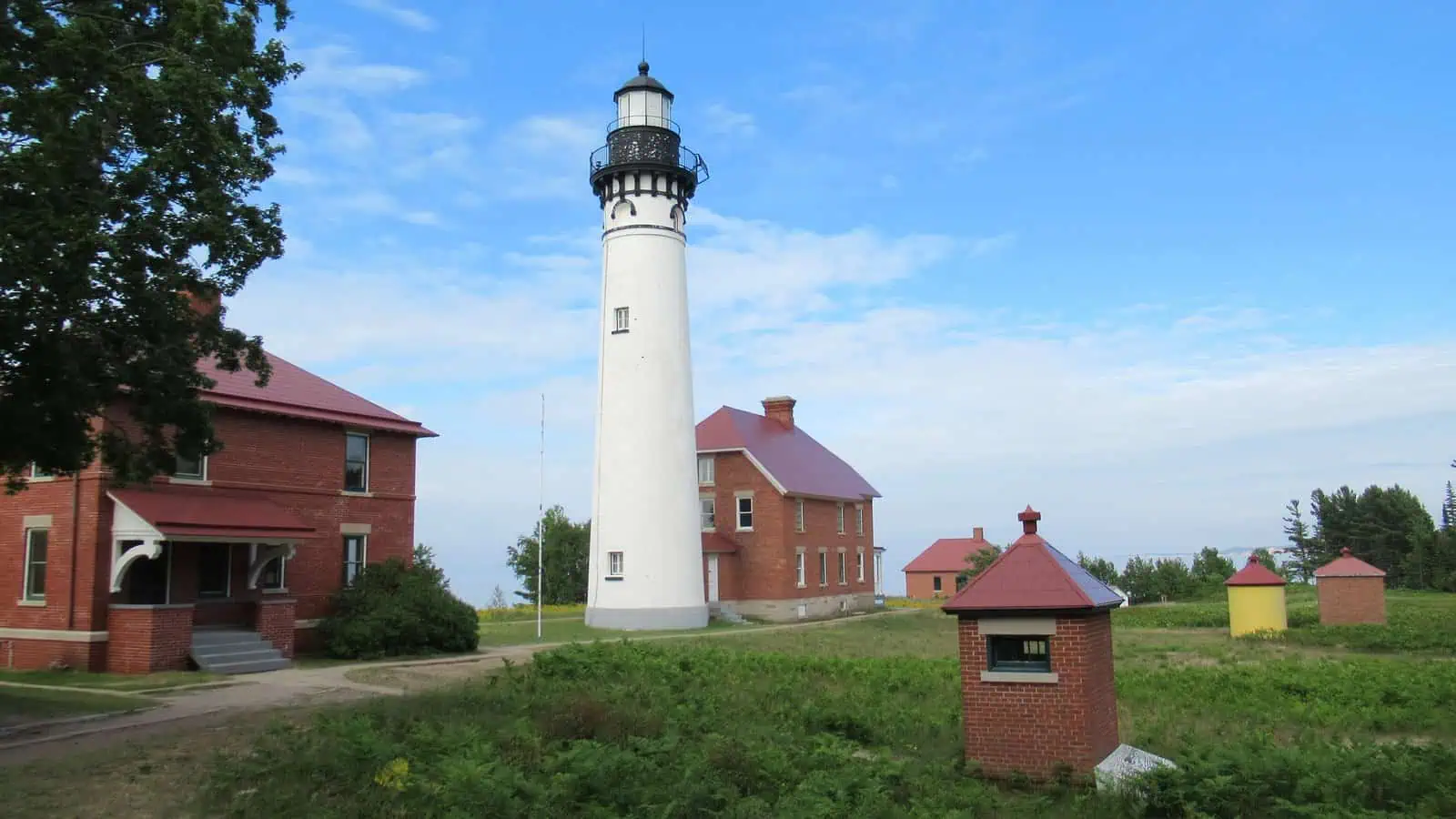
So in 1873 the government started building a warning. The tower they raised on Au Sable Point is eighty-six feet of brick, sixteen feet across at the base, and it does not stop at the ground: the foundation continues twenty-three feet down and is anchored in bedrock, because the thing was built to argue with Lake Superior for a very long time. The light came on in 1874. A third-order Fresnel lens threw a fixed white beam that could be seen seventeen miles out, burning lard oil at first and kerosene later, which means the first version of this life-saving technology was, essentially, a very sophisticated way of setting pig fat on fire.
Somebody had to keep it lit. Keepers and their families lived out on the point for eighty-four years, hauling supplies, trimming wicks, and tending the light through every November the lake could throw at them. There was no town. There still is not one. The keepers stayed until 1958, when the Coast Guard automated the light and the last of them left, and in 1968 the station passed to the National Park Service, which is how a working lighthouse ended up inside Pictured Rocks National Lakeshore.

Here is the part that makes Au Sable different from almost every other lighthouse you can visit: you cannot drive to it. The road ends at the Hurricane River campground, twelve miles west of Grand Marais on H-58, and from there the light station is a mile and a half on foot along the shore. That walk is the whole experience. Superior on one side, forest on the other, and then the white tower coming up through the trees exactly the way it must have for a keeper coming home with supplies.
The station is still there in working order, the light still runs, and in season the Park Service opens it up for tours. But the reef is still there too, six feet down, exactly as invisible as it was in 1859. The lake did not concede anything. The tower just made the argument permanent. It is the same argument the lake finally won at Whitefish Point in 1975, and the same coast where the Grand Sable Dunes drop five hundred feet to the water a few miles east.
Most of the U.P.’s lighthouses ask nothing of you. This one asks for an hour of walking, and it is the best trade on the shipwreck coast.
More worth reading


Yooper Hub community
The conversation
Know something this story missed? Corrections and additions get read by an editor and folded into the article, with credit.
Real neighbors, real names. A Yooper Hub editor reads your first comment before it appears; after that you’re a known neighbor and your comments post right away. No account required. Community guidelines
Nothing here yet. A sentence is plenty: a correction, a name, or what you remember about this place.
Sources, credits, and reporting details
Sources & accountability
How this story was reported
Editorial methodAggregation
Last verifiedAug. 14, 2026
Corrections statusNo material correction note is recorded on this article.
AI assistanceResearched and drafted with AI tools. Reviewed and approved by editor Keegan O’Brien. Tool: Claude.
Verification note: The wreck timbers on the beach walk (usually named as the Mary Jarecki, Sitka and Gale Staples) were deliberately left out: the NPS page naming them was unreachable during drafting. Confirm and add a sentence to the walk paragraph in a future pass.
Primary sources
-
Au Sable Light Station — National Park Service
Accessed Aug. 14, 2026.
Additional reporting
-
Au Sable Light — Wikipedia
Accessed Aug. 14, 2026.
Photo and media credits
-
Au Sable Light (June 2021) — Notorious4life / Wikimedia Commons
Featured image record. Accessed Aug. 14, 2026. CC0.
Supports: Photo credit for the featured image.
-
Au Sable Lighthouse from the water — National Park Service / Wikimedia Commons
Accessed Aug. 14, 2026. Public domain.
.jpg)
