There is a beach on the east side of the Keweenaw Peninsula that is the wrong color. It runs black-grey for miles south of a town called Gay, and it is not sand in any natural sense. It is crushed rock, pulverized to grit by machines that stopped running almost a century ago, and it is on the move.
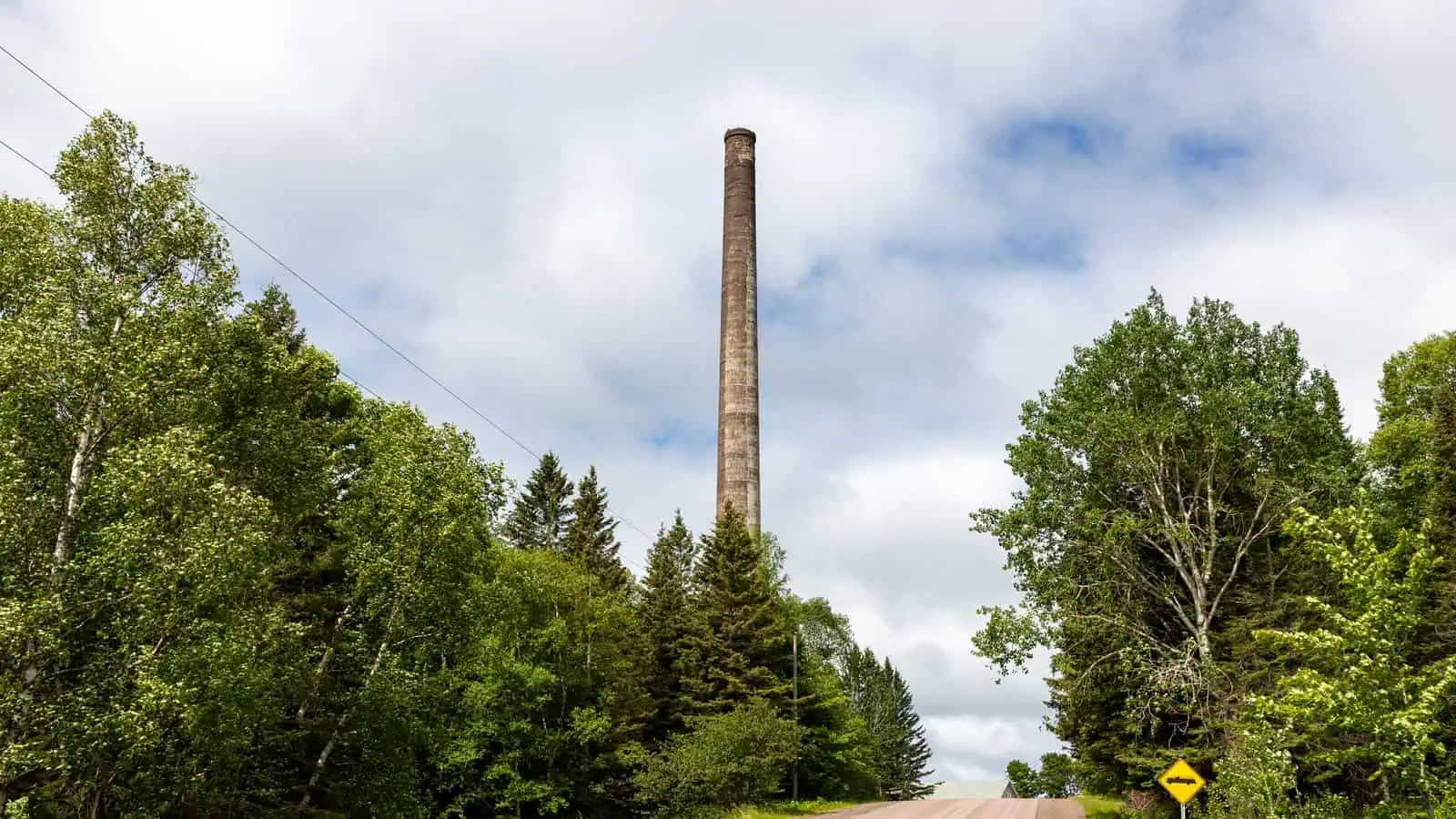
Gay existed to crush rock. The town went up in 1901, when the Mohawk and Wolverine mining companies each built a stamp mill on the shore of Lake Superior to smash copper ore into powder and float the metal out. By 1902 the whole mine-to-mill operation was running, and by 1922 about 1,500 people lived there with water, sewer and electric service, which was not nothing for a company town at the end of a peninsula. The mills took the ore, kept the copper, and sent everything else straight into the lake. The leftover grit is called stamp sand, and over three decades the mills at Gay put roughly 25 million tons of it into Superior.
Falling copper prices closed both mills in 1932. The town emptied out the slow way, the school in 1961, the trains in 1964, the post office in 1988, until what remained was a bar, a schoolhouse, a scatter of houses, and a 236-foot smokestack standing over the ruins like a headstone. If the story ended there it would be an ordinary Keweenaw ghost town story.
It does not end there, because the sand did not stay put.

Lake Superior has been picking up the black pile and carrying it south along the shore ever since the machines stopped. The original bank at Gay has been eroding into the lake at a measured rate of about 26 feet a year, and the Keweenaw County Historical Society puts the amount already underwater at the equivalent of 100,000 railroad cars. Over nearly a century the drift has moved the sand about five miles down the coast to the mouth of the Traverse River.
The problem is what sits just offshore there. Buffalo Reef is a 2,200-acre natural cobble reef, and it is one of the places where Lake Superior’s lake trout and lake whitefish spawn. Eggs survive in the gaps between cobbles. Stamp sand fills those gaps like grout, and it carries enough leftover copper to be toxic to the small life at the bottom of the food chain. By the state’s accounting, stamp sands now cover 1,426 acres of shoreline and lake bottom in the area, and at least 60 percent of the reef is no longer viable for spawning.
So there is now a fight to hold back a beach. A task force that includes the Great Lakes Indian Fish and Wildlife Commission, the Michigan DNR, the Army Corps of Engineers, Michigan Tech, Michigan State and the U.S. Geological Survey has been dredging as a holding action, 36,000 cubic yards from the Traverse River harbor and 178,000 more from a trough offshore, while the longer-term options get argued out: wall the pile off in the lake, dig it out and landfill it, or haul it across the peninsula to the old White Pine mine workings. None of the options is small, which is the honest measure of the problem.
The copper era gave the U.P. its towns, its immigrants, its whole identity. Gay is where you can watch it still collecting a bill, ninety years after the last shift ended. The smokestack marks where the money was made. The black shore moving toward the whitefish marks what it cost.
More worth reading


Yooper Hub community
The conversation
Know something this story missed? Corrections and additions get read by an editor and folded into the article, with credit.
Real neighbors, real names. A Yooper Hub editor reads your first comment before it appears; after that you’re a known neighbor and your comments post right away. No account required. Community guidelines
Nothing here yet. A sentence is plenty: a correction, a name, or what you remember about this place.
Sources, credits, and reporting details
Sources & accountability
How this story was reported
Editorial methodAggregation
Last verifiedAug. 14, 2026
Corrections statusNo material correction note is recorded on this article.
AI assistanceResearched and drafted with AI tools. Reviewed and approved by editor Keegan O’Brien. Tool: Claude.
Verification note: Copper toxicity is stated only at the level the agency sources support. The naming of the town for Joseph E. Gay is commonly repeated but was not confirmed in a consulted source, so it is not in the copy. No dollar figures for cleanup or fishery appear because none were sourced.
Primary sources
-
Saving Buffalo Reef — Michigan Department of Environment, Great Lakes, and Energy
Accessed Aug. 14, 2026.
-
Migrating Sands and Buffalo Reef — Keweenaw County Historical Society
Accessed Aug. 14, 2026.
Additional reporting
-
Historic Town of Gay historical marker — Michigan historical marker / HMdb
Accessed Aug. 14, 2026.
Photo and media credits
-
Smoke Stack Gay Michigan 2021-4352 — Paul R. Burley / Wikimedia Commons
Featured image record. Published Jun. 19, 2021. Accessed Aug. 14, 2026. CC BY-SA 4.0.
Supports: Photo credit for the featured image.
-
Smoke Stack Gay Michigan 2021-4334 — Paul R. Burley / Wikimedia Commons
Published Jun. 19, 2021. Accessed Aug. 14, 2026. CC BY-SA 4.0.

