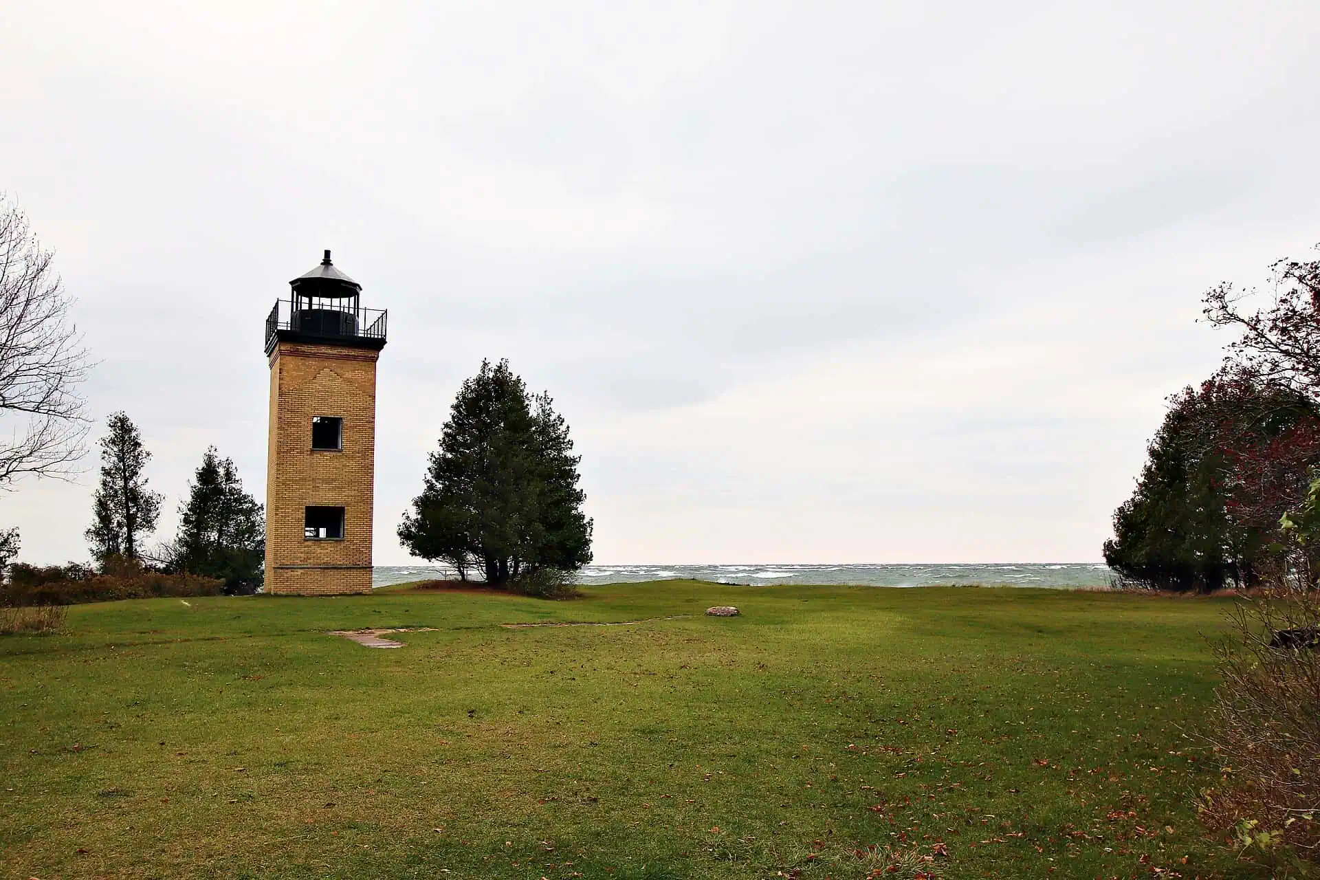
A few weeks from now, at the very tip of the Stonington Peninsula, the cedar trees around an old brick lighthouse will start to flutter orange. Locals call it monarch madness, and it is one of the quiet annual wonders of the U.P.: from mid-August into September, monarch butterflies from across the Upper Peninsula, Wisconsin, Minnesota, and Canada funnel down this one skinny finger of land between Little and Big Bays de Noc, gather in the trees at Peninsula Point, and wait for the right wind to jump Lake Michigan.
The reason is simple and a little heartbreaking. A monarch weighs about half a gram, has a wingspan under four inches, and is trying to fly roughly 1,900 miles to the mountains of central Mexico. It does not cross big open water carelessly. So southbound monarchs ride the peninsula as far as land will carry them, and the point at the end is the jumping-off place. As a longtime coordinator of the annual counts put it, “Peninsula Point at the end is a perfect place for them to funnel down.” At night they roost in the dense cedars near the lighthouse — the thick cover protects them — clustered with wings folded, warming up for the crossing toward Door County, Wisconsin, on the far side of the mouth of Green Bay.
Monarch madness
Volunteers have counted the monarchs here since 1996, starting each morning with a roost count on the lighthouse grounds and adding two walking censuses. Counts run daily through the fall migration, so any one morning is a partial picture. In the project’s first seven years volunteers counted 22,539 monarchs in all, with yearly totals ranging from 757 in 1998 to 6,638 in 1997. The eastern monarch population has fallen by roughly 80 percent since the 1990s, and the U.S. Fish and Wildlife Service proposed listing the species as threatened in December 2024. As of July 2026 there is still no final ruling. The migration comes anyway, every year, and few places in Michigan put you inside it like this one.
The lighthouse that would not quit
The tower they gather around has its own survivor story. Congress funded a lighthouse here after Escanaba’s iron-ore docks opened in 1864, and the brick tower went up in 1865 — a keeper hand-tending an oil lamp every night until an automated acetylene light took over in 1922. The Minneapolis Shoal light made it obsolete in 1936, the Forest Service took the property in 1937, and the Civilian Conservation Corps turned the point into a picnic ground. By 1948, vandalized and unfunded, the tower was slated for possible demolition — until the local Stonington Grange adopted it, restored it, and won first prize in the 1949 statewide Grange community-service contest for the effort. The keeper’s house burned in 1959. The brick tower shrugged, survived, made the National Register of Historic Places, and today visitors can climb its 40-foot spiral staircase and look out over both bays.
The whole place rewards the drive down the Stonington: a 1.2-mile interpretive trail through the woods (2.2 miles as a loop with the old two-track), flat limestone shoreline full of fossils 400 to 500 million years old, and spring bird migrations that can top 200 species — points of land like this one catch travelers of every size. Getting there takes some commitment: the point is about 17 miles down County Road 513 from US-2 east of Rapid River, and the Forest Service does not recommend the last 0.8 mile, a narrow and winding single-lane stretch, for RVs or trailers longer than 16 feet.
But late summer belongs to the monarchs. For a few weeks, the old brick light on the Bays de Noc goes quietly back to work, marking the departure point for travelers with four-inch wingspans. Then some September morning the wind swings right, the cedars empty almost all at once, and a cloud of half-gram sailors strikes out over Lake Michigan for Mexico — leaving behind an empty lighthouse, a quiet point, and every Yooper lucky enough to have been standing there when they went.
Go See It
Peninsula Point Lighthouse, Rapid River
- Hours
- No daily hours are posted by the Forest Service.
- Cost
- No fee is listed on the Forest Service page.
- Season
- Listed by the Forest Service as January to December. Peak monarch migration is between August and October.
- Drive
- From Marquette: 1 hr 22 min (72 mi) via US-41 S
From the Bridge: 2 hr 25 min (144 mi) via US-2 W (toll on the Bridge)
More worth reading


Sources, credits, and reporting details
Sources & accountability
How this story was reported
Editorial methodArchival synthesis
Last verifiedSep. 11, 2026
Corrections statusNo material correction note is recorded on this article.
AI assistanceResearched and drafted with AI tools. Reviewed and approved by editor Keegan O’Brien.
Verification note: Initial ledger, verified 2026-07-21 during publication prep. Migration behavior, count logistics, decline figures and the full lighthouse chronology checked against the Forest Service page, contemporaneous local reporting, and trail references. Sole direct quotation is a thirteen-word sentence via the Escanaba Daily Press. Featured image CC BY-SA 4.0, credit Emily Graham, resized without cropping. No AI-generated or AI-assisted media. Updated 2026-09-11 after a re-verification pass. Corrections: "the light first shone in 1865" replaced with the tower going up in 1865, since no source checked gives a first-lit year; the unsourced "3,000 or more monarchs a decade ago" and "80 percent since the 1980s" replaced with the published record (MonarchNet: project since 1996, a morning roost count plus two walking censuses; Meitner, Brower and Davis 2004: 22,539 monarchs over seven years, yearly totals 757 in 1998 to 6,638 in 1997; USFWS: proposed threatened December 2024, approximately 80 percent decline in the eastern migratory population, no final ruling yet); "anyone can climb … for free" narrowed to "visitors can climb" per the Forest Service wording; added the Forest Service access detail (CR 513, last 0.8 mile single-lane, not recommended for RVs or trailers over 16 feet); and the unverifiable "oldest navigation aid on the Bays de Noc" was cut. No count-season dates are asserted: MonarchNet gives Sept 1 to Oct 30 and the 2004 paper describes a different window, so the claim is left out. Awaiting Keegan's re-attestation.
Primary sources
-
Recreation Site: Peninsula Point Lighthouse — U.S. Forest Service, Hiawatha National Forest
Featured image record. Accessed Jul. 21, 2026. Federal public information.
-
Peninsula Point Monitoring Project — MonarchNet
Featured image record. Accessed Sep. 11, 2026.
-
Migration Patterns and Environmental Effects on Stopover of Monarch Butterflies at Peninsula Point, Michigan — Meitner, Brower and Davis, Environmental Entomology 33(2):249, 2004
Featured image record. Published Apr. 1, 2004. Accessed Sep. 11, 2026.
-
Monarch Butterfly Proposed for Endangered Species Act Protection — U.S. Fish and Wildlife Service
Featured image record. Published Dec. 10, 2024. Accessed Sep. 11, 2026.
-
Save the Monarch — U.S. Fish and Wildlife Service
Featured image record. Accessed Sep. 11, 2026.
Supports: There has not yet been a final ruling on the listing proposal.
-
Peninsula Point Lighthouse (Hiawatha National Forest) — USDA Forest Service
Featured image record. Accessed Sep. 11, 2026.
Additional reporting
-
Monarch butterflies gather at Stonington Peninsula to prepare for migration south — Escanaba Daily Press via The Daily News (R. R. Branstrom)
Featured image record. Published Aug. 25, 2023. Accessed Jul. 21, 2026. Copyright Ogden Newspapers; brief quotation with attribution.
Sole direct quotation in the article is the thirteen-word funnel sentence.
-
Peninsula Point Interpretive Trail — MichiganTrailMaps.com (Jim DuFresne)
Featured image record. Accessed Jul. 21, 2026. Copyright MichiganTrailMaps; cited.
-
Peninsula Point Light — Wikipedia
Featured image record. Accessed Jul. 21, 2026. CC BY-SA text; cited.
Photo and media credits
-
72 Peninsula Point Lighthouse (36)1.jpg — Emily Graham / Wikimedia Commons
Featured image record. Accessed Jul. 21, 2026. CC BY-SA 4.0; credit Emily Graham.
1.jpg)