US-41 is 1,990 miles long, and it runs out of road in the woods past Copper Harbor. Keep going anyway. A rough two-track called Rocket Range Road carries on past Schlatter Lake toward High Rock Bay at the very tip of the Keweenaw — four-wheel-drive, ORV, mountain bike, or snowmobile territory, depending on the season. At the end, in a clearing on the Lake Superior shore, sits a cracked concrete pad, a curved iron rail etched with degree markings, and a battered stone marker. This was Michigan’s spaceport.
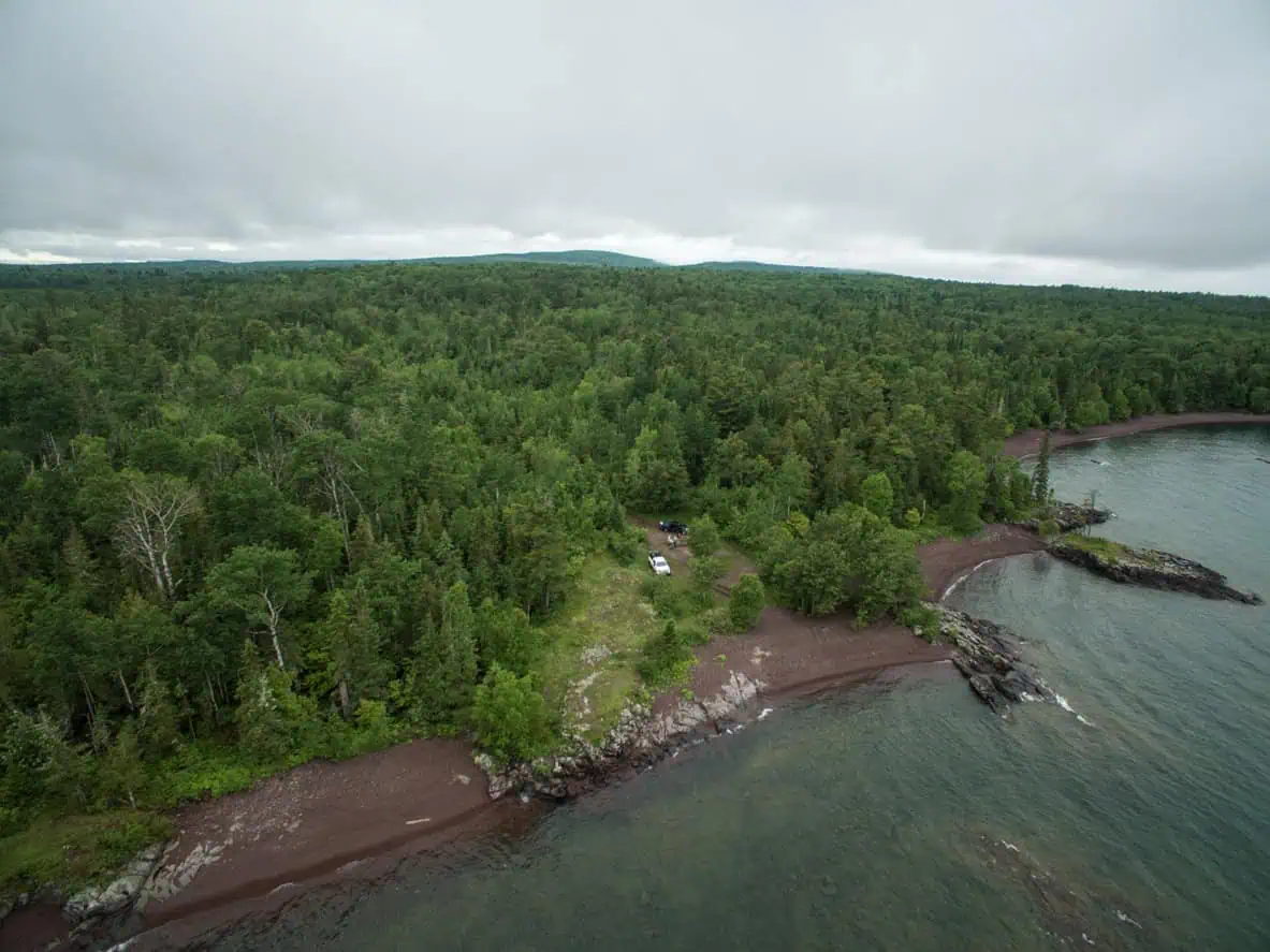
The idea came in 1962, when University of Michigan officials suggested that the remote Superior shoreline would make a fine place to launch research rockets: ten miles from the nearest town, water on three sides, and nothing downrange but the biggest lake on Earth. By 1964 the Keweenaw Rocket Range was live — a joint operation of NASA and the University of Michigan, folded into the national Meteorological Rocket Network, staffed by U-M professors alongside crew members from the Air Force’s White Sands Missile Range, who brought a launcher north with them.
Rockets over the big lake
The first shot came at 7:07 on the morning of August 6, 1964: an Arcas sounding rocket, six feet long and 76 pounds, that climbed 41 miles in a five-minute flight and parachuted into Lake Superior 20 miles offshore, radioing back temperature, pressure, density, and wind readings as it went. The team mostly let the spent payloads go where they fell. The one time they bothered to retrieve one, it had lodged high in a tree — so they cut down the entire tree rather than send anyone up after it. Another rocket eventually washed ashore all the way down by Marquette.
Because Superior’s shipping lanes sat downrange, launches were held mostly in winter, when the freighters stopped running — which meant rocket science at the tip of the Keweenaw came with lake-effect snow. The program grew anyway. Instruments went up to measure electron density, solar X-rays, and the precipitation of energetic electrons into the atmosphere, and the little Arcas rounds gave way to two-stage Nike Apache rockets roughly 28 feet tall, flown under the direction of NASA’s Goddard Space Flight Center.
January 29, 1971
Then came the day the U.P. touched space. The stone marker in the woods states it plainly: “Michigan’s first rocket to enter space was launched from this site” — on January 29, 1971. The final campaign that winter sent Nike Apaches roughly 100 miles up to study the sudden warming events that scramble the upper atmosphere in deep winter, the biggest rockets the site ever flew.
And then, almost as quickly as it began, it was over. Funding thinned, the site’s glorious remoteness cut both ways, and after the 1971 season the whole operation was packed up and hauled out — heated buildings, launch gantry, everything. The forest closed back in. What survives is what you can stand on today: the Nike Apache pad, the aiming rail bent into its arc, and the marker, chipped and weathered by fifty-odd years of Superior’s opinions. The Copper Harbor visitor center keeps a photograph of a 1964 Arcas sitting on its White Sands launcher, in case anyone doubts the story.
Getting there is the pilgrimage. Off-roaders run Rocket Range Road; riders take the Point Trail out of Copper Harbor, some of the best singletrack in the state, to reach a launch pad by mountain bike. Florida got the palm trees, the countdown clocks, and the television cameras. The U.P. got seven winters of rockets over the big lake, a slab in the woods, and the honest bragging right that Michigan’s road to space starts exactly where US-41 stops.
More worth reading


Sources, credits, and reporting details
Sources & accountability
How this story was reported
Editorial methodArchival synthesis
Last verifiedJul. 19, 2026
Corrections statusNo material correction note is recorded on this article.
AI assistanceResearched and drafted with AI tools. Reviewed and approved by editor Keegan O’Brien.
Verification note: Initial ledger, verified 2026-07-19 during publication prep. Launch dates, rocket types, measurements and site details checked against the Michigan Tech public-history account and supporting coverage. Sole direct quotation is an eleven-word fragment of the site marker as reproduced by Marquette Monthly and KMI. Featured image CC BY-SA 4.0, credit Roman Kahler, used without cropping. No AI-generated or AI-assisted media.
Primary sources
-
Keweenaw Rocket Range, Military History of the Upper Great Lakes — Michigan Technological University public-history project
Featured image record. Published Oct. 15, 2016. Accessed Jul. 19, 2026. University public-history project; cited.
Additional reporting
-
Keweenaw Rocket Range — Atlas Obscura
Featured image record. Accessed Jul. 19, 2026. Copyright Atlas Obscura; cited.
-
KMI Retrospective: Keweenaw Rocket Range — Marquette Monthly, reprinted by KMI
Featured image record. Accessed Jul. 19, 2026. Copyright Marquette Monthly; brief quotation with attribution.
Feature by Liza Fust, originally run in Marquette Monthly in 2019. Sole direct quotation in the article is an eleven-word marker fragment.
-
Keweenaw Rocket Range — Wikipedia
Featured image record. Accessed Jul. 19, 2026. CC BY-SA text; cited.
-
Tip of the Keweenaw — Trails and Travel
Featured image record. Accessed Jul. 19, 2026. Copyright trailsandtravel.com; cited.
-
Exploring the Keweenaw Rocket Range — Northern Michigan History
Featured image record. Accessed Jul. 19, 2026. Copyright northernmichiganhistory.com; cited.
Photo and media credits
-
Keweenaw Rocket Range.jpg — Roman Kahler / Wikimedia Commons
Featured image record. Published Jun. 30, 2017. Accessed Jul. 19, 2026. CC BY-SA 4.0; credit Roman Kahler.
