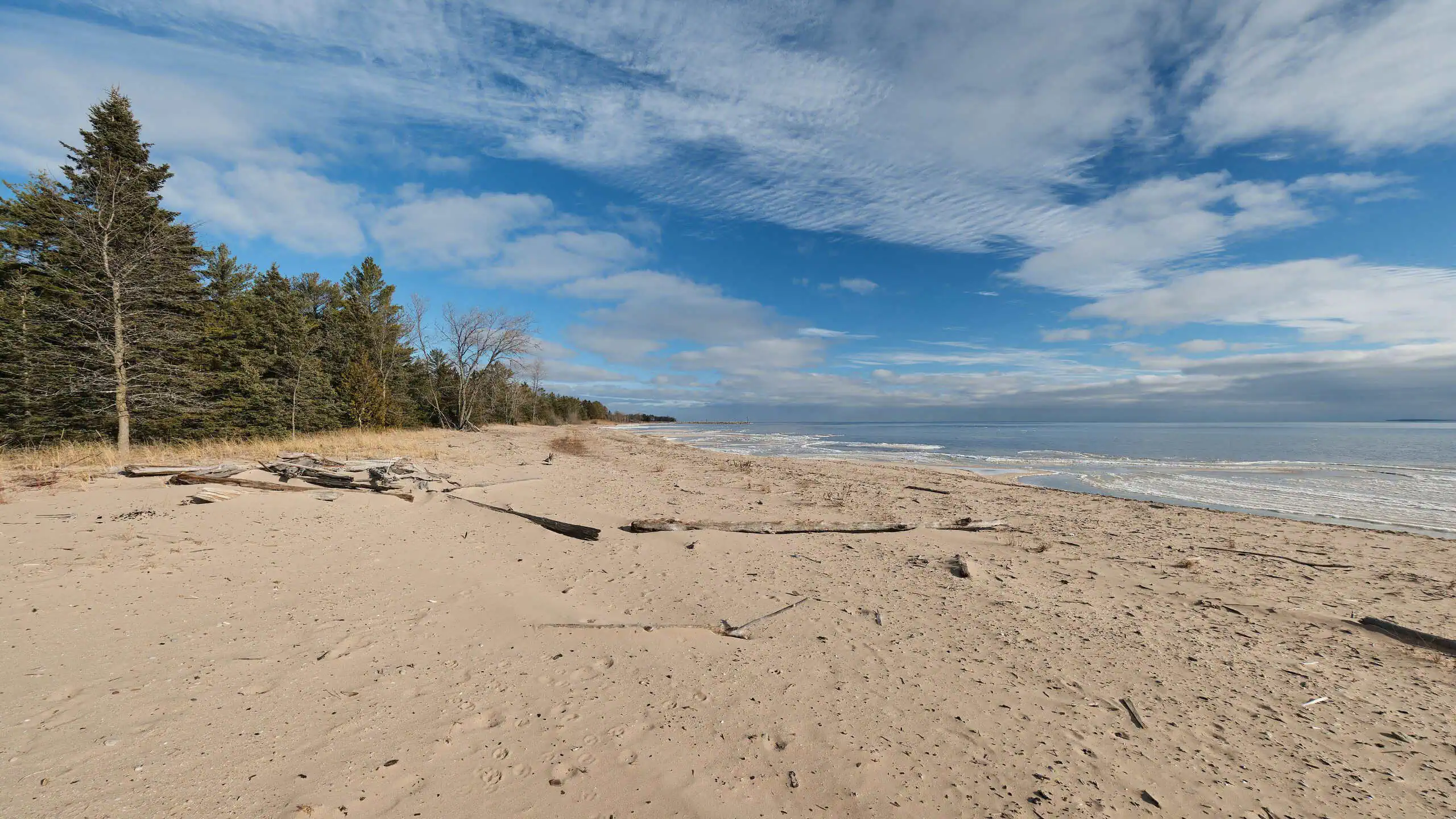
J.W. Wells State Park is three miles of Lake Michigan’s Green Bay shoreline on M-35, about 30 miles south of Escanaba, and Michigan got it as a gift. The Michigan DNR, which runs the park, says it was established in 1925 and “donated to the State of Michigan by the children of John Walter Wells, a pioneer lumberman in the area.” Wells, a former mayor of Menominee, died in 1921.
WLUC’s 2019 story for the state parks centennial told it differently, saying the land “was donated to the state by former Menominee mayor and lumberman, John Walter Wells.” The gift came from his children, four years after his death by the arithmetic of those two dates. The park carries his name. His children gave it.

The 500 acres a logger left standing
The woods behind the beach have their own backstory. CampMichigan.org’s history of the park says Sam Crawford bought 53,000 acres of stumpland around Menominee in 1898 to log the hemlock growing among the pine stumps. Five hundred of those acres were still virgin timber, and that account says Crawford “intentionally preserved it.” Wells, part owner of the Bird-Wells Lumber Company, later bought the land.
The same history puts the 1925 gift at 335 acres of virgin timber with 2.5 miles of shoreline, plus 131 acres the Menominee County Road Commission had bought. The DNR now lists the park at 700 acres along 3 miles of Green Bay. Whether any of that original forest still stands untouched is not something the DNR’s park page claims, so we are not claiming it either.
What the CCC built by hand
Much of what you walk past was built during the Depression. The DNR says “many of the park’s buildings, landscaping, and water and sewage systems were built by the Civilian Conservation Corps in the 1930s and 1940s.” CampMichigan puts a 200-man CCC camp in the park from 1933. The National Park Service lists the park on the National Register of Historic Places, entered Feb. 25, 2002.

The Bay Stone Lodge is the CCC’s work too. The DNR says it was built in the 1940s, served for years as the park manager’s house, and now rents to the public and sleeps 11, with hand-hewn beams and a cut-stone fireplace.
Five cabins and a hand pump
Five rustic cabins rent here, and the DNR lists them by name: Poverty sleeps 8, Rock sleeps 10 and has a covered porch, Washington sleeps 12, Summer sleeps 9, and St. Martin sleeps 10 in three rooms. None has running water or electricity inside. Each has its own vault toilet and a hand pump for water.
The modern campground has 150 sites, and the DNR says most are flat and within view of the lake. From the observation platform on the Cedar River Trail you look across Green Bay to Door County, Wisconsin. Last winter the park cleared ash trees out of the campground, and its own notice promises “extra sunshine and improved views this season.”
Cedar River State Harbor, a couple of miles north, has a boat launch and an accessible walkway along the river that the DNR says is popular for fishing. A campground host told WLUC in 2019 the park is one of the hidden gems of the southern U.P., and that some people “drive past it every day and don’t notice it.”
Go See It
J.W. Wells State Park, Cedar River
- Hours
- Day use 8 a.m. to 10 p.m. daily (DNR statewide state park rule).
- Cost
- Recreation Passport required for vehicle entry: $15 for Michigan residents at plate renewal in 2026; nonresidents $12 a day or $42 a year. Camping, cabins and the lodge are extra.
- Season
- The DNR park page posts no closing date for the campground. Call 906-863-9747 before counting on a campsite or modern restrooms in late fall. Cabins have no running water at any time of year.
- Drive
- From Marquette: 1 hr 44 min (95.9 mi) via US-41 S and M-35 S
From the Bridge: 2 hr 55 min (174 mi) via US-2 W
More worth reading


Yooper Hub community
The conversation
Know something this story missed? Corrections and additions get read by an editor and folded into the article, with credit.
Real neighbors, real names. A Yooper Hub editor reads your first comment before it appears; after that you’re a known neighbor and your comments post right away. No account required. Community guidelines
Nothing here yet. A sentence is plenty: a correction, a name, or what you remember about this place.
Sources, credits, and reporting details
Sources & accountability
How this story was reported
Editorial methodAggregation
Last verifiedOct. 5, 2026
Corrections statusNo material correction note is recorded on this article.
AI assistanceResearched and drafted with AI tools. Reviewed and approved by editor Keegan O’Brien.
Verification note: Sources read and checked Oct. 5, 2026.
Primary sources
-
J.W. Wells State Park — Michigan DNR
Accessed Oct. 5, 2026.
Supports: 3 miles of Green Bay shore; 30 miles south of Escanaba; across from Door County
[Chrome] "J.W. Wells State Park is located along 3 miles of Lake Michigan's Green Bay, just 30 miles south of Escanaba in Michigan's Upper Peninsula and across the bay from Door County, Wisconsin."
-
J.W. Wells State Park — Michigan DNR
Accessed Oct. 5, 2026.
Supports: 700 acres; modern campground, swim beach, rustic cabins, trail with warming shelters
[Chrome] "The 700-acre park is home to a modern campground, a designated swim beach, a picnic area, rustic cabins and a trail with three warming shelters."
-
J.W. Wells State Park — Michigan DNR
Accessed Oct. 5, 2026.
Supports: Established 1925; donated by the children of John Walter Wells, pioneer lumberman
[Chrome] "The park, established in 1925, was donated to the State of Michigan by the children of John Walter Wells, a pioneer lumberman in the area."
-
J.W. Wells State Park — Michigan DNR
Accessed Oct. 5, 2026.
Supports: CCC built buildings, landscaping, water and sewage systems in the 1930s and 1940s
[Chrome] "Many of the park's buildings, landscaping, and water and sewage systems were built by the Civilian Conservation Corps in the 1930s and 1940s."
-
J.W. Wells State Park — Michigan DNR
Accessed Oct. 5, 2026.
Supports: Ash trees cleared from campground last winter
[Chrome] "We were busy this past winter clearing ash trees to keep our campground thriving and safe. While your favorite spot might look a bit different, we're excited for the extra sunshine and improved views this season!"
-
J.W. Wells State Park — Michigan DNR
Accessed Oct. 5, 2026.
Supports: Cedar River State Harbor a couple miles north; boat launch; accessible walkway popular for fishing
[Chrome] "Cedar River State Harbor, located just a couple miles to the north, offers a boating access site and an accessible walkway along the river that is popular for fishing and educational programs."
-
J.W. Wells State Park — Michigan DNR
Accessed Oct. 5, 2026.
Supports: Address and phone; Recreation Passport required
[Chrome] "N7670 Highway M-35, Cedar River, Michigan, 49887" / "Phone: 906-863-9747" / "A Recreation Passport (park pass) is required for vehicle entry"
-
Wells Modern Campground (DNR park subpage) — Michigan DNR
Accessed Oct. 5, 2026.
Supports: 150 modern sites; most flat and within view of the lake
[reader] Number of sites: 150. "Most sites are considered flat and within view of Lake Michigan."
-
Wells Rustic Cabins (DNR park subpage) — Michigan DNR
Accessed Oct. 5, 2026.
Supports: Five cabins by name and capacity
[reader] "The Poverty (sleeps 8), Rock (sleeps 10, with a covered porch), Washington (sleeps 12), and Summer (sleeps 9) cabins are charming one-room layouts." / "The St. Martin cabin (sleeps 10) provides a more spacious three-room setup."
-
Wells Rustic Cabins (DNR park subpage) — Michigan DNR
Accessed Oct. 5, 2026.
Supports: No running water or electricity in cabins; vault toilet and hand pump each
[reader] "Please note there's no running water or electricity inside the cabins; however, each cabin has its own vault toilet and a hand pump for water."
-
Wells Bay Stone Lodge (DNR park subpage) — Michigan DNR
Accessed Oct. 5, 2026.
[reader] "Originally built by the Civilian Conservation Corps in the 1940s, the lodge served as the park manager's residence for many years." / "The lodge sleeps 11" / "The lodge has hand-hewn beams, hardwood floors and a cut-stone fireplace with a gas insert"
-
J.W. Wells State Park (observation platform) — Michigan DNR
Accessed Oct. 5, 2026.
Supports: Observation platform on the Cedar River Trail; view to Door County
[reader] "An observation platform, located along the park's accessible Cedar River Trail in the day-use area, provides a gorgeous view of Lake Michigan and Door County"
-
State park rules — Michigan DNR
Accessed Oct. 5, 2026.
Supports: Day-use hours 8 a.m. to 10 p.m.
[reader] "State parks and recreation area day-use hours are open 8 a.m. to 10 p.m. daily."
-
Recreation Passport — Michigan DNR
Accessed Oct. 5, 2026.
Supports: 2026 prices: $15 resident vehicle; nonresident $42 annual, $12 daily; up $1 Jan. 1, 2026
[Chrome] "Effective Jan. 1, 2026, the cost of the Recreation Passport increased by $1." / nonresident "Annual $42" / "Daily $12"; [reader] resident vehicles "$15"
-
Contemporary accounts of J. W.'s life — The Menominee Wellses (family site reprinting Menominee Herald-Leader obituary, Aug. 17, 1921, and Sawyer 1911)
Accessed Oct. 5, 2026.
Supports: Wells was mayor of Menominee; died 1921
[reader] "had the distinction of holding the office of mayor of Menominee"; obituary dated Aug. 17, 1921 (page heading confirmed in Chrome)
-
Wells, J.W., State Park (NRIS 02000040) — National Park Service
Accessed Oct. 5, 2026.
Supports: National Register listing Feb. 25, 2002
[reader] Listed "2/25/2002"
-
Derived: years between death and gift — YooperHub calculation
Accessed Oct. 5, 2026.
Supports: Four years between Wells's death (1921) and the gift (1925)
Calculated: 1925 – 1921 = 4. Labelled in text as arithmetic.
-
Google Maps directions, Marquette to J.W. Wells State Park — Google Maps
Accessed Oct. 5, 2026.
Supports: Drive time from Marquette
Fastest route read live Oct 5, 2026: 1 hr 44 min (95.9 mi) via US-41 S and M-35 S. Destination point 45.3953513, -87.3672995.
-
Google Maps directions, Mackinac Bridge to J.W. Wells State Park — Google Maps
Accessed Oct. 5, 2026.
Supports: Drive time from Mackinac Bridge
Fastest route read live Oct 5, 2026: 2 hr 55 min (174 mi) via US-2 W.
Additional reporting
-
Michigan State Parks Centennial: J.W. Wells State Park — WLUC-TV6 (Tyler J Markle)
Published Jul. 30, 2019. Accessed Oct. 5, 2026.
Supports: CORRECTION (other coverage): WLUC says Wells donated the land himself
[Chrome] "Wells State Park was established in 1925. The land was donated to the state by former Menominee mayor and lumberman, John Walter Wells." Contradicted by the DNR (children donated) and by his 1921 death.
-
Michigan State Parks Centennial: J.W. Wells State Park — WLUC-TV6 (Tyler J Markle)
Published Jul. 30, 2019. Accessed Oct. 5, 2026.
Supports: Campground host quote: hidden gem; people drive past
[Chrome] "It's one of the hidden gems of the Southern Upper Peninsula, and a lot of people don't even know it's here," said campground host Glynne Van Dyke. "Some drive past it every day and don't notice it."
-
The Start of J.W. Wells State Park — CampMichigan.org (Mike Sonnenberg)
Published Jan. 23, 2019. Accessed Oct. 5, 2026.
[Chrome] "In 1898, Sam Crawford purchased fifty-three thousand acres of stumpland around Menominee and began logging operations on the hemlock growing among the pine stumps. Five hundred of these acres were was still virgin timber, and Crawford intentionally preserved it. John Walter Wells, part owner of the Bird-Wells Lumber Company, later purchase this land. Wells died in 1921"
-
The Start of J.W. Wells State Park — CampMichigan.org (Mike Sonnenberg)
Published Jan. 23, 2019. Accessed Oct. 5, 2026.
[Chrome] "in 1925 his children donated 335 acres of virgin timber, including 2.5 miles of Lake Michigan shoreline" / "An additional 131 acres which had been purchased by the Menominee County Road Commission was added" / "In 1933, a two-hundred man camp was established"
Photo and media credits
-
Beach by Lake Michigan in J. W. Wells State Park (53895794586).jpg (media 4109) — Wikimedia Commons / Chris Rycroft
Featured image record. Accessed Oct. 5, 2026. CC BY 2.0.
Supports: Image credit and licence.
Commons file page metadata read Oct 5, 2026: licence CC BY 2.0, author Chris Rycroft. Original 8298×4668; uploaded 2560×1440 (downscaled, not cropped). Viewed before alt text was written.
-
Sunset at J.W. Wells State Park.jpg (media 4108) — Wikimedia Commons / AaronJoePick
Accessed Oct. 5, 2026. CC BY-SA 4.0.
Supports: Image credit and licence.
Commons file page metadata read Oct 5, 2026: licence CC BY-SA 4.0, author AaronJoePick. Original 3264×2448; uploaded 1920×1440 (downscaled, not cropped). Viewed before alt text was written.
-
Shelter in J. W. Wells State Park (53896134594).jpg (media 4111) — Wikimedia Commons / Chris Rycroft
Accessed Oct. 5, 2026. CC BY 2.0.
Supports: Image credit and licence.
Commons file page metadata read Oct 5, 2026: licence CC BY 2.0, author Chris Rycroft. Original 7983×4990; uploaded 2560×1600 (downscaled, not cropped). Viewed before alt text was written.
.jpg)

.jpg)