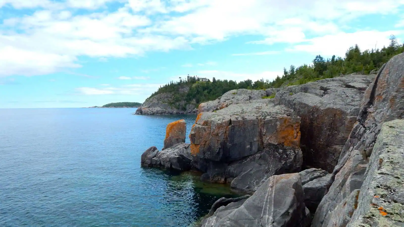
Three miles off the Lake Superior shore between L’Anse and Big Bay there is a group of eight small islands made of granite that is more than a billion years old. Nobody lives on them. Almost nobody is allowed to land on them. On the westernmost one, at the top of a cliff about a hundred feet above the water, there is a square stone lighthouse that has been lit every navigation season since October 20, 1868.
The reason it exists is a boat full of cattle.
The Lighthouse Board had wanted a light on the Huron Islands for years. In 1865 it told Congress the islands were a constant source of anxiety to navigators, which is a bureaucrat’s way of saying ships kept hitting them. But the case had already been made five years earlier, on the morning of May 29, 1860, when the side-wheel steamer Arctic ran onto one of the islands in dense fog with passengers, freight and a load of livestock aboard.
Everyone got off. So did the cattle. They stood on the bare rock for two days until the upbound steamer Fountain City came by and took the people off. The cattle were left where they were, long enough that the island has been called Cattle Island ever since. The Arctic’s anchor sits in the waterfront park at L’Anse today.
Congress appropriated $17,000 on July 28, 1866. Then the government spent more than a year clearing title to the island it wanted, so nothing was built until the spring of 1868. When the crews did arrive they built the light out of the island itself: rough-cut granite blocks quarried on the spot, with limestone for the corners and window frames. The tower is not quite 40 feet tall, attached to a story-and-a-half keeper’s house, but the rock it stands on does the work. The light’s focal plane is 198 feet above the lake.
Getting anything up there was the problem. A road had to be blasted from the shoreline to the summit, with wooden bridges over the gaps. In 1882 a tramway went in to haul supplies up the cliff, and in 1887 a steam hoist so coal could be brought up for the fog signal boilers. A basin built across a fissure in the rock to catch water was destroyed by ice the first winter.
The first keeper was Abel Hall, who had come to the Upper Peninsula in the early 1840s with the surveying party of William Austin Burt and Douglass Houghton and stayed. He kept the light for eleven years with his sons Charles and Frank helping.
The keeper who is remembered, though, is Frank Witte. He came in 1901, and in 1905, when Theodore Roosevelt made the islands a national bird sanctuary to protect the herring gulls that nest there, Witte was made its warden. Four years later, on April 30, 1909, the schooner barge George C. Nester broke its tow line in a storm and was driven onto the rocks of Lighthouse Island, just north of the fog signal. Witte tried to reach the crew and broke his collar bone doing it. All seven men aboard drowned. He said afterward that the spray was going nearly 200 feet into the air, higher than the light. In June he found one of the bodies floating off the north end of the island.
Three years later the Lighthouse Service gave the station its efficiency pennant as the model post in the district. Witte retired in 1914.
The light was electrified in the 1930s and manned by the Coast Guard until 1972, when it was automated. The Coast Guard let it go in 1997 and ownership went to the U.S. Fish and Wildlife Service, which already ran the islands. Roosevelt’s bird sanctuary is the Huron National Wildlife Refuge now: 147 acres across the eight islands, 79 species of birds, and every island closed to the public except the one with the lighthouse. You can land there by your own boat in daylight and walk the grounds. The tower and the house are locked.
A group of local people formed the Huron Island Lighthouse Preservation Association in 1999 and spent years raising money for a roof, which went on in 2006. The original Fresnel lens is at the Marquette Maritime Museum. Whatever you see from shore on a clear day, that small square shape on the far rock, is the granite tower a crew cut out of the island in 1868, still doing what it was built to do because a steamboat once put its cattle ashore in the wrong place.
More worth reading


Yooper Hub community
The conversation
Know something this story missed? Corrections and additions get read by an editor and folded into the article, with credit.
Real neighbors, real names. A Yooper Hub editor reads your first comment before it appears; after that you’re a known neighbor and your comments post right away. No account required. Community guidelines
Nothing here yet. A sentence is plenty: a correction, a name, or what you remember about this place.
Sources, credits, and reporting details
Sources & accountability
How this story was reported
Editorial methodArchival synthesis
Last verifiedAug. 15, 2026
Corrections statusNo material correction note is recorded on this article.
AI assistanceResearched and drafted with AI tools. Reviewed and approved by editor Keegan O’Brien. Tool: Claude.
Verification note: Drafted 2026-08-15 from the U.S. Fish and Wildlife Service refuge page and Lighthousefriends' station history. Accounts differ on which island the Arctic struck and on the cattle's fate; the copy says 'one of the islands' and that the cattle were left.
Primary sources
-
Huron National Wildlife Refuge — U.S. Fish and Wildlife Service
Accessed Aug. 15, 2026.
-
Huron Island Lighthouse — Lighthousefriends.com
Accessed Aug. 15, 2026.
Compiles Lighthouse Board annual reports and period newspapers; the standard secondary source for Great Lakes station histories.
Additional reporting
-
Huron Islands (Wikipedia) — Wikipedia contributors
Accessed Aug. 15, 2026.
Pointer only.
Photo and media credits
-
Lighthouse and Keeper's Quarters at Huron National Wildlife Refuge (featured image) — U.S. Fish and Wildlife Service, via Wikimedia Commons
Featured image record. Published Aug. 3, 2015. Accessed Aug. 15, 2026. Public domain (U.S. federal government work).
Original 4608×3456, cropped 16:9 (box 0,389,4608,2981), resized to 1600×900 q85. Attachment 2420.
.jpg)