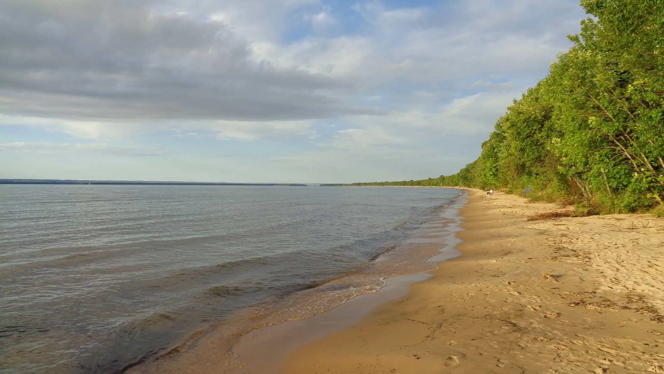
Brimley State Park is about 2,000 feet of sandy Lake Superior shoreline on Whitefish Bay, and the land it started with was a gift from the village next door. The Michigan DNR says the park “was established in 1923 when the Village of Brimley gifted the park’s initial acreage to the DNR.” WLUC, in its 2019 centennial story, put that first gift at 38 acres.
The park now covers 100 acres, according to the DNR, which runs it. Michigan’s own tourism site, michigan.org, copies the DNR’s description almost word for word but says “home to 160 acres of lakeside recreation.” The DNR’s figure is 100.

What you come for
The DNR says that from the shoreline or the observation area “visitors enjoy watching passing freighters and the view of Canada across the lake.” WLUC described them as “nearly 1,000 foot freighters.” A park guide put it plainly in that story: “It’s a laid back park. We don’t have extensive trail systems.”
The water comes with a claim. The park’s unit supervisor, Corey Butcher, told WLUC: “Our water tends to be a little bit warmer here, just because we’re here at the eastern end of Lake Superior.” That is the park’s own claim, and it stops at a little bit warmer.
Butcher also pointed WLUC to Lime Island, which he described as a 930-acre island in the St. Marys River about two and a half miles east of Raber, with cabins the public rents and wooden tent platforms.
One of the old ones, not the oldest
The DNR calls Brimley “one of the oldest state parks in the Upper Peninsula,” and the qualifier matters. In a 2019 history piece the DNR gave the title of first mainland state park in the U.P. to Baraga State Park, established in 1922, a year before Brimley. Michigan’s state park commission itself only dates to 1919.

The bay the beach faces has its own place in Michigan law. Central Michigan University’s Clarke Historical Library records that a Bay Mills tribal fisherman was arrested on Sept. 28, 1971, in Pendills Bay, “a part of Whitefish Bay.” The case became People v. LeBlanc, in which the Michigan Supreme Court ruled in December 1976 that bands party to the 1836 treaty kept treaty-based fishing rights.
Going in late October
The park has 237 modern campsites and one mini cabin, and the DNR’s camping table lists their season as May 15 to Oct. 14, so the campground is done for the year by now. Day use runs 8 a.m. to 10 p.m., and a Recreation Passport gets the car in. Point Iroquois Lighthouse, a short drive west, ended its own season Oct. 16, per the Forest Service. The DNR also points anglers to designated trout streams within a 30-minute drive in the Hiawatha National Forest.
Inside the park are a boat launch, a picnic area and shelter, and a buoyed swim area. The DNR pitches it as a base for two national fish hatcheries, the Hiawatha National Forest, Sault Ste. Marie and the Soo Locks.
Go See It
Brimley State Park, Brimley
- Hours
- Day use 8 a.m. to 10 p.m. daily (DNR statewide state park rule).
- Cost
- Recreation Passport required for vehicle entry: $15 for Michigan residents at plate renewal in 2026; nonresidents $12 a day or $42 a year.
- Season
- Campground and mini cabin: May 15 to Oct. 14 (DNR camping rates and dates table). Day use year-round under DNR hours.
- Drive
- From Marquette: 2 hr 29 min (150 mi) via M-28 E
From the Bridge: 50 min (48.6 mi) via I-75 N
More worth reading


Yooper Hub community
The conversation
Know something this story missed? Corrections and additions get read by an editor and folded into the article, with credit.
Real neighbors, real names. A Yooper Hub editor reads your first comment before it appears; after that you’re a known neighbor and your comments post right away. No account required. Community guidelines
Nothing here yet. A sentence is plenty: a correction, a name, or what you remember about this place.
Sources, credits, and reporting details
Sources & accountability
How this story was reported
Editorial methodAggregation
Last verifiedOct. 5, 2026
Corrections statusNo material correction note is recorded on this article.
AI assistanceResearched and drafted with AI tools. Reviewed and approved by editor Keegan O’Brien.
Verification note: Sources read and checked Oct. 5, 2026.
Primary sources
-
Brimley State Park — Michigan DNR
Accessed Oct. 5, 2026.
Supports: 100 acres on Whitefish Bay; one of the oldest U.P. state parks; 1923 village gift
[Chrome] "Brimley State Park, located along the beautiful shore of Lake Superior's Whitefish Bay, is home to 100 acres of lakeside recreation. The park is one of the oldest state parks in the Upper Peninsula and was established in 1923 when the Village of Brimley gifted the park's initial acreage to the DNR."
-
Brimley State Park — Michigan DNR
Accessed Oct. 5, 2026.
[Chrome] "The park is home to a campground, overnight lodging facility, boat launch, sandy swimming beach, picnic area and shelter. From the sandy shoreline or observation area, visitors enjoy watching passing freighters and the view of Canada across the lake." / "a number of designated trout streams are located within a 30-minute drive of the park in the Hiawatha National Forest" / "including two national fish hatcheries, the Hiawatha National Forest, the town of Sault Ste. Marie and the Soo Locks"
-
Brimley State Park — Michigan DNR
Accessed Oct. 5, 2026.
Supports: Address, phone, directions
[Chrome] "9200 W. 6 Mile Road, Brimley, Michigan, 49715" / "Phone: 906-248-3422" / "From I-75, take exit 386 and come to M-28 heading west for 7 miles. Turn right at the M-28 and M-221 intersection and travel for 2 miles. Turn right at 6 Mile Road and travel three-quarters of a mile"
-
Brimley State Park (campground and beach subpages) — Michigan DNR
Accessed Oct. 5, 2026.
Supports: 2,000 ft of shoreline; 237 sites; 1 mini cabin; buoyed swim area; pets outside swim area
[reader] "Enjoy 2,000 feet of sandy shoreline stretching along Lake Superior." / "Number of sites: 237" / mini cabin "Number of sites: 1" / "The park has a buoyed swim area is in the park's day-use area." / "Pets are allowed along the Lake Superior shoreline outside of the buoyed swim area."
-
Camping and lodging rates and operating dates — Michigan DNR
Accessed Oct. 5, 2026.
Supports: Brimley campground and mini cabin season May 15 to Oct 14
[reader] Brimley Campground season "May 15" to "October 14"; Mini Cabin same dates. Table did not render in Chrome (interactive table).
-
Showcasing the DNR: The UP's first mainland state park — Michigan DNR
Published Aug. 15, 2019. Accessed Oct. 5, 2026.
Supports: Baraga first mainland U.P. state park, 1922 (qualifies 'one of the oldest')
[Chrome] "The park was the first mainland state park in the Upper Peninsula, established in 1922."
-
Showcasing the DNR: Michigan's early parks development — Michigan DNR
Published Feb. 22, 2019. Accessed Oct. 5, 2026.
Supports: State Park Commission established May 12, 1919
[Chrome] "the Michigan State Park Commission, which was established by the state Legislature on May 12, 1919"
-
Treaty Rights and The Great Lakes Fishery — Clarke Historical Library, Central Michigan University
Accessed Oct. 5, 2026.
[Chrome] "That arrest took place on September 28, 1971 in Pendills Bay of Lake Superior, a part of Whitefish Bay." / "In December 1976 the State Supreme Court ruled in People v. LeBlanc that Odawa and Chippewa bands party to the 1836 treaty retained treaty-based fishing rights"
-
Point Iroquois Lighthouse — USDA Forest Service, Hiawatha National Forest
Accessed Oct. 5, 2026.
Supports: Season June 9 through Oct 16
[reader] "Operating season: June 9th through October 16th."
-
State parks general rules — Michigan DNR
Accessed Oct. 5, 2026.
Supports: Day use 8 a.m. to 10 p.m.
[reader] "State parks and recreation area day-use hours are open 8 a.m. to 10 p.m. daily."
-
Recreation Passport — Michigan DNR
Accessed Oct. 5, 2026.
Supports: 2026 prices
[Chrome] "Effective Jan. 1, 2026, the cost of the Recreation Passport increased by $1." / "Annual $42" / "Daily $12"; [reader] resident vehicles "$15"
-
Google Maps directions, Marquette to Brimley State Park — Google Maps
Accessed Oct. 5, 2026.
Supports: Drive time from Marquette
Fastest route read live Oct 5, 2026: 2 hr 29 min (150 mi) via M-28 E.
-
Google Maps directions, Mackinac Bridge to Brimley State Park — Google Maps
Accessed Oct. 5, 2026.
Supports: Drive time from Mackinac Bridge
Fastest route read live Oct 5, 2026: 50 min (48.6 mi) via I-75 N. Destination point 46.4133767, -84.5563421.
Additional reporting
-
Brimley State Park (listing) — Travel Michigan (michigan.org)
Accessed Oct. 5, 2026.
Supports: CORRECTION (other coverage): says 160 acres
[Chrome] "Brimley State Park, located along the beautiful shore of Lake Superior's Whitefish Bay, is home to 160 acres of lakeside recreation." DNR says 100.
-
Michigan State Parks Centennial: Brimley State Park — WLUC-TV6 (Remi Murrey)
Published Aug. 1, 2019. Accessed Oct. 5, 2026.
Supports: Initial 38 acres in 1923; about 2,000 ft shoreline; nearly 1,000-ft freighters
[Chrome] "Established in 1923, the initial 38 acres of land was gifted to the state by the village of Brimley." / "Visitors also can watch the nearly 1,000 foot freighters pass as they camp outside."
-
Michigan State Parks Centennial: Brimley State Park — WLUC-TV6 (Remi Murrey)
Published Aug. 1, 2019. Accessed Oct. 5, 2026.
Supports: Butcher: water a little bit warmer; Bland: laid back park; Lime Island 930 acres, cabins, platforms
[Chrome] "Our water tends to be a little bit warmer here, just because we're here at the eastern end of Lake Superior," (Unit Supervisor Corey Butcher) / "It's a laid back park. We don't have extensive trail systems," (Park Explorer Guide Laura Bland) / "Lime Island is located about two and a half miles east of the little town of Raber … It's a 930 acre island that sits in the middle of the St. Mary's River, and on Lime Island, we have cabins that are rented by the public. We also have some wooden camping tent platforms."
Photo and media credits
-
Brimley State Park.JPG (media 4129) — Wikimedia Commons / Notorious4life
Featured image record. Accessed Oct. 5, 2026. CC0.
Supports: Image credit and licence.
Commons file page metadata read Oct 5, 2026: licence CC0, author Notorious4life. Original 5152×2898; uploaded 2560×1440 (not cropped; downscaled only if wider than 2560). Viewed before alt text was written.
-
Brimley State Park Entrance.jpg (media 4130) — Wikimedia Commons / rossograph
Accessed Oct. 5, 2026. CC BY-SA 4.0.
Supports: Image credit and licence.
Commons file page metadata read Oct 5, 2026: licence CC BY-SA 4.0, author rossograph. Original 3353×2332; uploaded 2560×1780 (not cropped; downscaled only if wider than 2560). Viewed before alt text was written.
-
Brimley State Park Picnic Shelter.jpg (media 4131) — Wikimedia Commons / rossograph
Accessed Oct. 5, 2026. CC BY-SA 4.0.
Supports: Image credit and licence.
Commons file page metadata read Oct 5, 2026: licence CC BY-SA 4.0, author rossograph. Original 5184×3456; uploaded 2560×1707 (not cropped; downscaled only if wider than 2560). Viewed before alt text was written.


