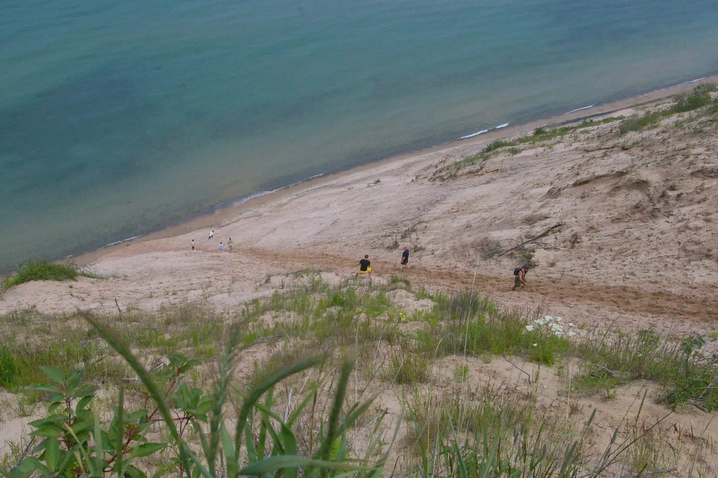

Drive out to the Log Slide east of Munising and you get one of the great views in Michigan: a wall of sand and gravel dropping about 300 feet straight into Lake Superior at an angle so steep it looks like it should be sliding into the lake as you watch. It does not. And the reason why is the part most visitors never learn.
The Grand Sable Dunes cover about five square miles of the eastern end of Pictured Rocks National Lakeshore, near Grand Marais. Yes, the U.P. has real sand dunes, big ones, not just the famous stretch down at Sleeping Bear. What makes these ones different is what is holding them up.

The secret is that it is not really a sand dune
The towering banks below the dunes are not sand at all. They are a ridge of glacial gravel and debris left behind when the ice sheets melted, and gravel can hold a far steeper angle than loose sand ever could. The actual sand dunes sit perched on top of that gravel bank, adding roughly another hundred feet. Geologists call it a perched dune system, and it is why the whole thing stands at an angle that pure sand would never survive.
It is also still growing. As people scramble up and slide down the face, they knock sand loose, and the wind carries those grains up and over the top. Grain by grain, foot traffic actually builds the dune higher over time instead of wearing it down.

The log slide that supposedly caught fire
The Log Slide gets its name from the 1880s, when loggers built a wooden chute here to send timber down the dune to Lake Superior, where boats hauled it away. According to local lore, logs shot down the dry chute fast enough that the friction sometimes set the wood on fire. The chute is long gone, but the interpretive trail and the overlook still trace the path the timber took.
The warning worth taking seriously
Here is the practical part. From the overlook you can walk down to the water, and it is tempting. The Park Service is blunt about it: going down takes about five minutes, and climbing back up through shifting sand can take an hour or more. Rangers have carried out multiple exhausted and injured hikers over the years, and rescue is slow this far from help.
The signs at the top spell it out. Do not attempt the climb back if you have a heart condition or are not in good shape, carry water, and give yourself far more time than you think you will need. Plenty of people hike down in a good mood and regret it badly halfway back up.
If you would rather just take in the view, the overlook itself is a short, easy walk from the Log Slide parking area off County Road H-58, about seven miles west of Grand Marais. On a clear day you can see the Au Sable Light Station to the west and the dunes rolling five miles to the east.
Sources, credits, and reporting details
Sources & accountability
How this story was reported
Legacy source review pending. This published article has not yet passed Yooper’s current source-readiness gate.
Editorial methodNot yet classified
Image provenanceAI imagery status not yet declared
Accountable reviewerNot yet assigned
Last verifiedNot yet recorded
Sources: the National Park Service (Pictured Rocks National Lakeshore) and U.S. Geological Survey research on the Grand Sable perched dune system.
Direct links, claim-level support, dates, credits, and editorial accountability may still be incomplete.