The bill for getting the black sand off Buffalo Reef now stands at $2.1 billion. That is the latest long-term estimate for the Buffalo Reef cleanup, reported by the Daily Mining Gazette in May and repeated in Michigan DNR releases. The money covers a jetty, a landfill and decades of dredging south of Gay in Keweenaw County.
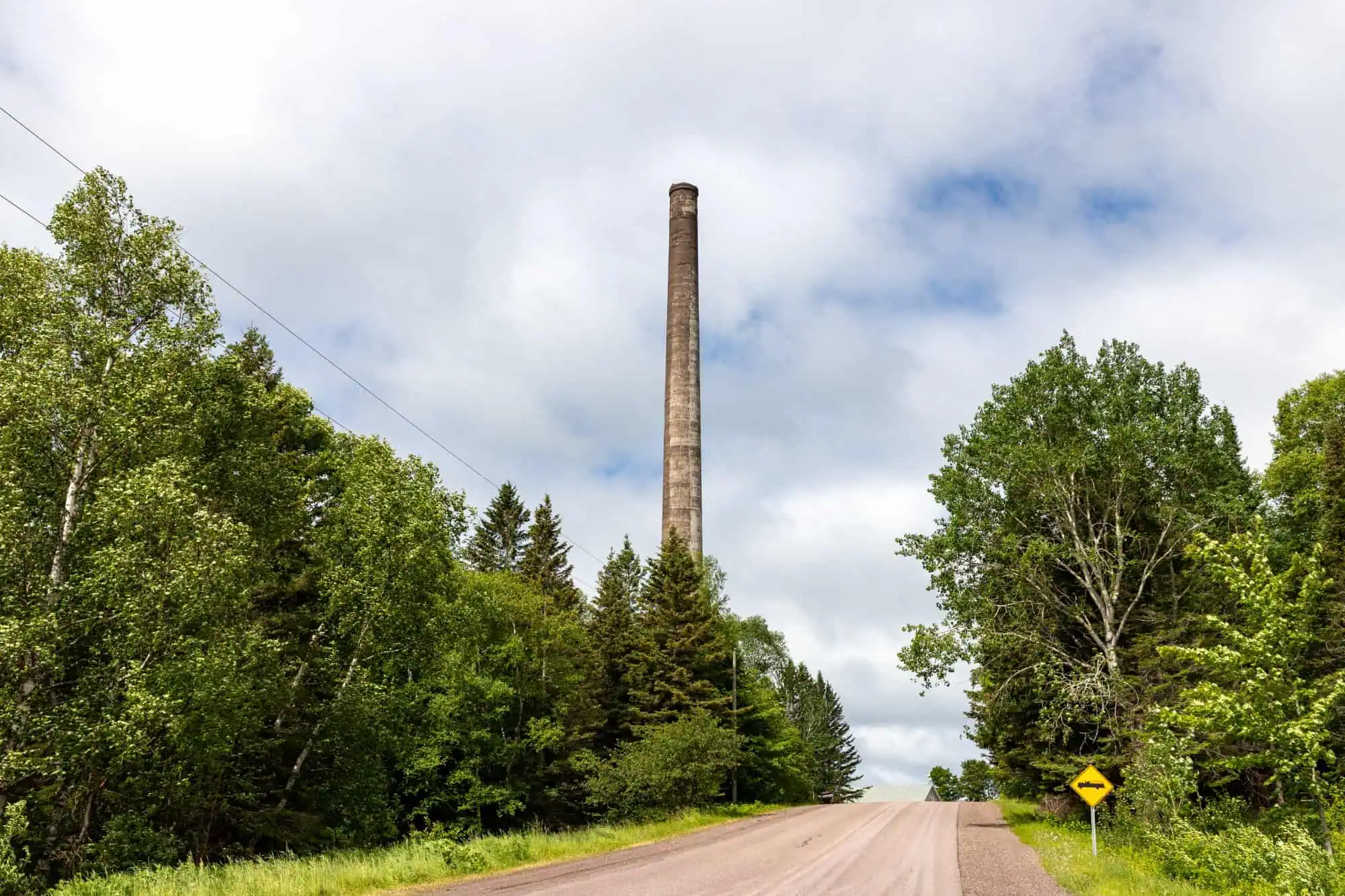
The reef is a 2,200-acre cobble bed under Lake Superior where lake trout and whitefish spawn. EGLE’s Saving Buffalo Reef page says stamp sand from the Mohawk and Wolverine mills, which stopped milling at Gay in 1932, has drifted about five miles south onto it. Today 1,426 acres of shoreline and lake bottom are covered, and the state estimates at least 60 percent of the reef is no longer viable for spawning.
We told the mill story in August. This is the money story: what has been dug, what has been paid for, and what the plan looks like in 2026. The original piece is here.

What has actually been dug
EGLE says the EPA put $3.1 million toward new dredging in 2017, and an Army Corps contractor finished dredging Grand Traverse Harbor and a stretch of beach north of it in September 2019. In October 2019 a DNR contractor took down a 30-foot cliff of stamp sand at the water’s edge at Gay, 175,000 cubic yards, which EGLE says had been shedding an average of 26 feet of material a year into the lake.
Then there is the trough. The Mining Journal described it in 2018 as “the ancient riverbed area north of Buffalo Reef,” a natural ditch that catches sand before it reaches the cobble, and reported the EPA sent the Corps an extra $946,000 in Great Lakes Restoration Initiative money to dredge it. EGLE says the Corps hydraulically dredged that depression in 2020, pulled 112,000 cubic yards out of Lake Superior, and placed it back on the existing stamp sand along the shore.
By our count the cliff removal and the trough dredge together moved about 287,000 cubic yards. The Gazette puts the original pile at nearly 23 million cubic yards, more than 90 percent of it now offshore. WCMU reported in 2024 that EGLE’s Stephanie Swart expects removing 12.7 million cubic yards to take decades.

The 2026 Buffalo Reef cleanup plan: a jetty and a landfill
The Buffalo Reef Task Force, created by the EPA, settled on an upland landfill. The DNR says a 2,000-foot jetty would be built to intercept the stamp sand as it migrates south. Jay Parent, EGLE’s district supervisor in Marquette, told the Keweenaw County Board of Commissioners in May that the landfill would be a 14-acre composite-lined Type III cell holding 500,000 cubic yards, the Gazette reported. Dredging 100,000 cubic yards a year, which Parent said has been done twice, would fill it in five years.
Parent put the jetty alone at $120 million and up, per the Gazette, and said the current landowner might want $6,000 an acre, so the state is working through the State Land Bank to get the site.
Funding so far is partial. The DNR says the project is funded in part through the Great Lakes Restoration Initiative and an appropriation from the State of Michigan. Parent told the DNR in October 2025 that geotechnical work for the jetty was done and design was expected within three months. That same month WNMU reported the planned stamp sand dredge was pushed to 2026 after a poor bidding environment and a potential conflict with the Corps.
Dredging did return to Grand Traverse Harbor in late April 2026. The DNR says this round is clean sand that piled up naturally, dredged to keep the harbor open while the long-term fix is designed. The Keweenaw Bay Indian Community sits on the task force, and the DNR credits KBIC and others with keeping the waterway open.
If you go
The black beach is at Gay in Keweenaw County, and Grand Traverse Harbor sits at the mouth of the Traverse River in Houghton County to the south. Open shoreline, free, no hours. The sand has had 94 years to get this far, by our count, and the first landfill cell fills in five.
More worth reading


Sources, credits, and reporting details
Sources & accountability
How this story was reported
Editorial methodAggregation
Last verifiedOct. 19, 2026
Corrections statusNo material correction note is recorded on this article.
AI assistanceResearched and drafted with AI tools. Reviewed and approved by editor Keegan O’Brien.
Verification note: Written October 19, 2026 for the 2026-10-21 edition; sources read and checked Oct. 19, 2026. AI-assisted drafting, staff desk piece.
Primary sources
-
Saving Buffalo Reef — Michigan EGLE
Accessed Oct. 19, 2026.
Fetched Oct 19, 2026: "Buffalo Reef is a 2,200-acre natural cobble feature beneath the waters of Lake Superior … Since milling operations at the Mohawk and Wolverine mines ended in 1932 … drifted the stamp sands south about five miles"
-
Saving Buffalo Reef — Michigan EGLE
Accessed Oct. 19, 2026.
Supports: 1,426 acres covered; at least 60 percent no longer viable
Fetched Oct 19, 2026: "Today, 1,426 acres of shoreline and lake bottom are covered by stamp sands. … at least 60 percent of Buffalo Reef is no longer viable for lake trout"
-
Saving Buffalo Reef — Michigan EGLE
Accessed Oct. 19, 2026.
Fetched Oct 19, 2026: "The U.S. Environmental Protection Agency provided $3.1 million for new dredging work in 2017 … in September 2019, a U.S. Army Corps of Engineers contractor completed dredging of Grand Traverse Harbor"
-
Saving Buffalo Reef — Michigan EGLE
Accessed Oct. 19, 2026.
Fetched Oct 19, 2026: "In October 2019, Michigan DNR's contractor removed a 30-foot-high cliff (175,000 cubic yards of stamp sands) … was eroding an average of 26 feet of material per year into Lake Superior."
-
Saving Buffalo Reef — Michigan EGLE
Accessed Oct. 19, 2026.
Fetched Oct 19, 2026: "During 2020 the U.S. Army Corps of Engineers conducted a hydraulic dredge of a depression north of the reef … The Corps removed 112,000 cubic yards out of Lake Superior and placed the material onto existing stamp sand"
-
Saving Buffalo Reef — Michigan EGLE
Accessed Oct. 19, 2026.
Supports: Task Force created by EPA; KBIC on task force (Evelyn Ravindran listed as member)
Fetched Oct 19, 2026: "A multi-entity Buffalo Reef Task Force was created by the U.S. Environmental Protection Agency … Evelyn Ravindran, Natural Resources Director, Keweenaw Bay Indian Community"
-
Addressing the issue at Buffalo Reef — Daily Mining Gazette
Published May. 21, 2026. Accessed Oct. 19, 2026.
Supports: $2.1 billion long-term estimate; nearly 23 million cubic yards; more than 90% offshore
Fetched Oct 19, 2026: "The most recent cost estimate for completing the long-term project is $2.1 billion over the length of its timeline. … Nearly 23 million cubic yards of the mining waste was originally deposited in Gay … more than 90% of it has washed offshore"
-
Addressing the issue at Buffalo Reef — Daily Mining Gazette
Published May. 21, 2026. Accessed Oct. 19, 2026.
Fetched Oct 19, 2026: "the proposed landfill is a 14-acre composite-lined area … That would get us 500,000 cubic yards of material. Dredging 100,000 per year, which has been done twice, would fill the area in five years"
-
Addressing the issue at Buffalo Reef — Daily Mining Gazette
Published May. 21, 2026. Accessed Oct. 19, 2026.
Supports: Jetty cost from $120 million; landowner might ask $6,000 per acre; state engaging State Land Bank
Fetched Oct 19, 2026: "Parent said the estimated cost of building a jetty ranged from $120 million to $450,000 million. … $6,000 per acre … engaging with the State land bank to get it"
-
Buffalo Reef dredging set to resume — Michigan DNR
Published Oct. 10, 2025. Accessed Oct. 19, 2026.
Fetched Oct 19, 2026: "funded in part through the Great Lakes Restoration Initiative and an appropriation from the State of Michigan … Geotechnical work for the proposed jetty was completed last fall, design is expected to be completed in three months"
-
DNR to delay dredging of Buffalo Reef — WNMU Public Radio 90
Published Oct. 12, 2025. Accessed Oct. 19, 2026.
Fetched Oct 19, 2026: "due to a poor bidding environment and potential conflict with the U.S. Army Corps of Engineers … is being rebid to be undertaken in 2026"
-
Grand Traverse Harbor dredging set to resume this week in Houghton County — Michigan DNR
Published Apr. 27, 2026. Accessed Oct. 19, 2026.
Fetched Oct 19, 2026: "Dredging crews will return to the Grand Traverse Harbor in Houghton County this week … This current dredging project is being done to combat clean sand that has naturally accumulated in the harbor"
Additional reporting
-
Army Corps announces additional funding for stamp sands project in Keweenaw Peninsula — The Mining Journal
Published Nov. 23, 2018. Accessed Oct. 19, 2026.
Fetched Oct 19, 2026: "The Environmental Protection Agency provided USACE with an additional $946,000 in Great Lakes Restoration Initiative funding … from the ancient riverbed area north of Buffalo Reef known as the 'trough'"
-
Buffalo Reef cleanup chugs along with 'decades-long' project — WCMU Public Media
Published Sep. 10, 2024. Accessed Oct. 19, 2026.
Fetched Oct 19, 2026: "Swart says cleanup will likely take decades in order to remove 12.7 million cubic yards of stamp sands."
-
Legacy Effects — Keweenaw County Historical Society
Accessed Oct. 19, 2026.
Fetched Oct 19, 2026: "the extensive shoreline deposits of dark stamp sands that now extend down to the Traverse River Harbor."
Photo and media credits
-
The 1923 concrete smokestack of the stamp mill at Gay, Keweenaw County — Wikimedia Commons / Paul R. Burley
Featured image record. Accessed Oct. 19, 2026. CC BY-SA 4.0 https://creativecommons.org/licenses/by-sa/4.0.
Supports: Featured image: The 1923 concrete smokestack of the stamp mill at Gay, Keweenaw County
Media ID 4403; resized to 2000px; credit in caption and alt
-
Lake Superior shoreline at Tobacco River Park, Gay, Michigan — Wikimedia Commons / Tony Webster
Accessed Oct. 19, 2026. CC BY 2.0 https://creativecommons.org/licenses/by/2.0.
Supports: Body image 2: Lake Superior shoreline at Tobacco River Park, Gay, Michigan
Media ID 4404; resized to 2000px; credit in caption and alt
-
Concrete ruins of the stamp mill at Gay, Keweenaw County — Wikimedia Commons / Paul R. Burley
Accessed Oct. 19, 2026. CC BY-SA 4.0 https://creativecommons.org/licenses/by-sa/4.0.
Supports: Body image 3: Concrete ruins of the stamp mill at Gay, Keweenaw County
Media ID 4405; resized to 2000px; credit in caption and alt


