Drive the back roads southwest of Grand Marais, in the eastern U.P., and you will come across something that stops people cold. An open plain, flat and quiet, studded as far as you can see with the silvered, weathered stumps of enormous trees. What grows between them is low: bracken fern, blueberry, black huckleberry and reindeer moss. It looks like a graveyard, and in a way it is. This is the Kingston Plains, a ghost forest, and the trees that once stood here have been gone for well over a century.
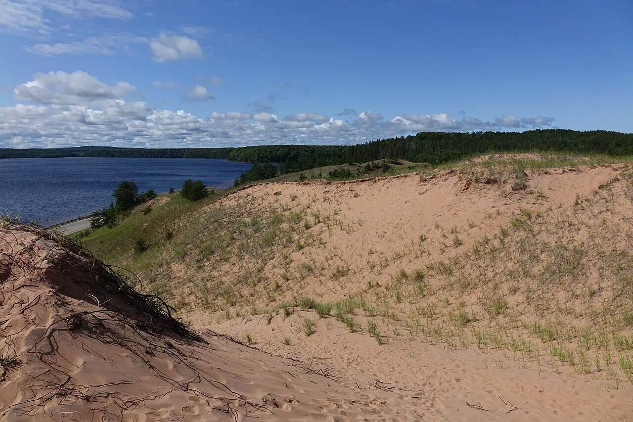
Not that long ago, this was one of the great white pine forests of Michigan, giant trees a hundred feet tall standing on the sandy ground. Then, in the late 1800s, the loggers came. A timber man named Thomas Sullivan ran crews that pulled around 50 million feet of white pine off these plains in roughly three years. In winter they sledded the massive logs over iced roads to the Grand Sable Dunes, hauled them to the top, and sent them down a wooden slide five hundred feet to barges waiting on Lake Superior, bound for the sawmills. What they left behind is what made all the difference.

Why the forest never came back
Loggers of that era practiced what is bluntly called cut and run. They took the valuable trunks and left everything else, the branches, the tops, the needles, scattered across the ground to dry. That debris became perfect fuel. Fires swept the cutover land again and again, and here they burned so hot that they did more than clear the surface. They cooked the seeds that would have started the next forest and burned the thin soil right down to the bare sand, while the wind carried off what topsoil remained. The land was, in effect, sterilized. More than a hundred and ten years later, the white pine forest still has not come back. What covers the ground instead is low: bracken fern, blueberry, black huckleberry and reindeer moss, with grasses and sedges barely present. The straight lines of trees you can spot on the horizon were planted by people, jack pine and red pine set out in a checkerboard in the 1960s. The state maintains the openings deliberately now, and keeps prescribed fire off them so the stumps survive.
A monument to a vanished forest
The Kingston Plains are not an isolated tragedy. They are a snapshot of what happened across the whole region. In the closing decades of the 1800s, the U.P.’s seemingly endless white pine was cut and shipped south to build Chicago and the fast-growing cities of the treeless Midwest. Forests that people genuinely believed could never be used up were gone within a generation, and the fires that followed turned huge stretches of the north into wasteland. Most of it eventually recovered into different forests of aspen, oak, and jack pine. The Kingston Plains are one of the places where that recovery stalled, which is exactly why they are worth seeing.
How to find it
The stump prairie sits along the Adams Trail, a dirt road running south from County Road H-58 between Grand Marais and Melstrand, on the edge of the Lake Superior State Forest and not far from Pictured Rocks. It is public land and free to wander. Photographers love it, and for good reason. The stumps are hauntingly beautiful in morning fog, at sunset, and especially under a clear night sky, since this corner of the U.P. is dark enough for brilliant stars and the occasional show of northern lights. Many of the stumps still carry the notches the loggers cut into them, a direct, physical link to the men who took the forest down.
It is a strange and quietly powerful place. Stand out there among all those weathered stumps, in the silence, and you are looking at both a ghost and a warning, the outline of a forest that was here long before any of us and a reminder of how quickly something that seems endless can disappear.
More worth reading


Yooper Hub community
The conversation
Know something this story missed? Corrections and additions get read by an editor and folded into the article, with credit.
Real neighbors, real names. A Yooper Hub editor reads your first comment before it appears; after that you’re a known neighbor and your comments post right away. No account required. Community guidelines
Nothing here yet. A sentence is plenty: a correction, a name, or what you remember about this place.
Sources, credits, and reporting details
Sources & accountability
How this story was reported
Editorial methodAggregation
Last verifiedJul. 13, 2026
Corrections statusNo material correction identified in the July 13, 2026 source review.
AI assistanceResearched and drafted with AI tools. Reviewed and approved by editor Keegan O’Brien.
Verification note: CEO-directed review checked the central claims against 1 direct public evidence link on July 13, 2026. No material correction was identified.
Primary sources
-
Direct evidence for: There’s a Ghost Forest in the U.P. Where the Trees Never Grew Back — Project
Accessed Jul. 13, 2026.
Direct public evidence reviewed against the article on July 13, 2026.
-
Eastern Upper Peninsula Regional State Forest Management Plan, MA 8 Danaher Kingston Outwash Management Area — Michigan Department of Natural Resources
Accessed Aug. 18, 2026.
Added 2026-08-18 after a reader correction on Facebook. The MSU Kingston Plains page already in this ledger documents the failure to regenerate but names no species.
Photo and media credits
-
grand-sable-dunes-h58 — Creator or rights holder named in the WordPress attachment caption
Featured image record. Accessed Jul. 13, 2026. public domain.
Supports: Featured image used by this article.
The Grand Sable Dunes along H-58 near the Kingston Plains, where loggers once hauled white pine up and sent it down to Lake Superior. Photo: National Park Service / public domain.